The colourful difference between base maps and public access maps
As Aotearoa’s legally mandated mapper of where people can and cannot go, Herenga ā Nuku often receives this type of question:
“Excuse me, but why are you sending walkers down my driveway?”
It’s a perfectly reasonable one, arising from a crucial difference in the two types of maps we need to use in our mapping system: first, base maps (background maps), and second, public access maps.
Specialised mapping systems require a base on which to place the extra data we gather and supply.
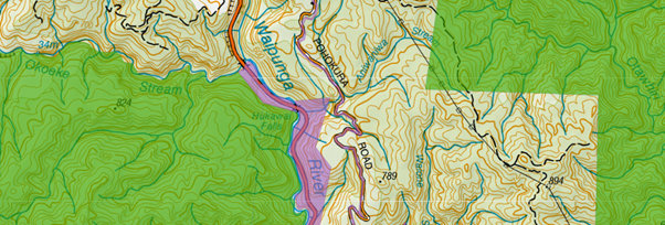
To tell the difference between the base maps and the public access layers, ask yourself: can you see just a few colours, or a lot?
Move the slider below to see the difference:
A few hues: Base maps
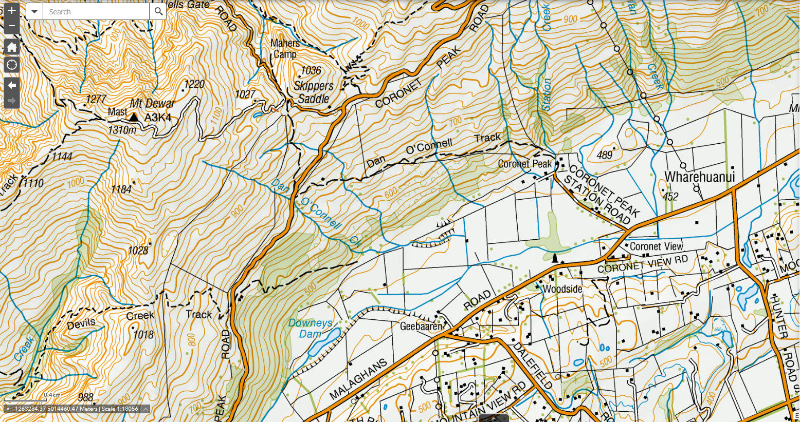
If the map has a limited palette, it’ll be a base map – such as the well-known NZ Topo 1:50,000, produced by Toitū Te Whenua | Land Information New Zealand (LINZ), the national mapping agency. Roughly speaking, it’s orange for roads, blue for water, green for vegetation, and black for other features.
The same applies to the other base maps we use, from Eagle Technology.

A section of the LINZ base map in use by Herenga ā Nuku’s mapping system, WAMS, alongside the tab with the other base map options.
When it comes to public access, there are two essential things to note about base maps:
- They say nothing about public access. They’re like aerial photography: all they do is show what was on the ground when they were made.
- We do not make, or control, the base maps. We use them out of necessity, as a foundation for our mapping data.
If you would like to try to correct these base maps (for example, to show that a particular route is not open to the public), you can – just not through us. Not because we do not want to help, but because we cannot. Here’s who to contact:
LINZ NZ Topo base maps
Eagle Technology Base Maps
Various data sources are used to build the basemap, which is updated every month. One of these is the Open Street Map (OSM), built and managed from crowd-sourced contributions from the community as well as core datasets from recognisable suppliers.
Because that data is crowd-sourced, if you recognise that a road is included incorrectly then this is the place to start:
Updating OSM: A Step-by-Step Guide
Google Base Maps
We also receive enquiries about issues such as private driveways appearing as public roads on Google Maps, even though we do not use Google Maps as a base map. When errors are spotted, as with OSM data, users can edit:
Add or fix a road in Google Maps – Google Maps Help
Multicoloured maps: public access layers
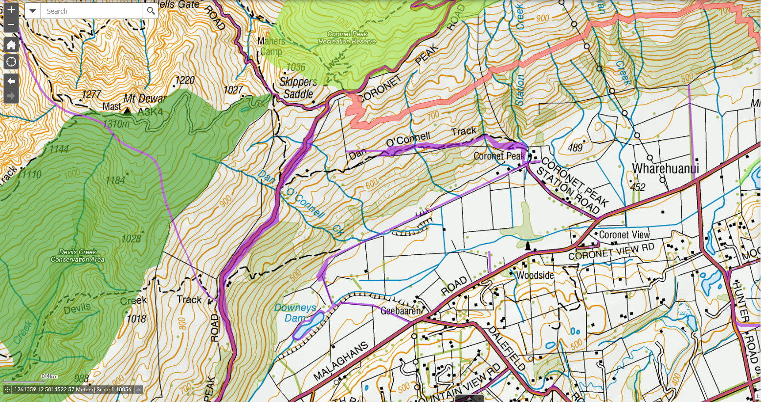
On the other hand, if you’re in our mapping system and you’re looking at a map that also has up to 12 other colours, including additional shades of green and blue, plus various shades of purple or pink, a sand colour and a peach one – then you’ve added a public access layer onto your base.
Now you can see exactly where people are legally allowed to access.
Just to paint a picture, here are the names of some of the colours we’re currently using to try to show as clearly as possible what’s public access, and what’s not:
- Road parcels — aster purple
- Easements — red
- Reserve land — light green
- Public Access Conservation Land — dark green
- Other parks and reserves — yellow
- Other public access areas — turquoise

A page from our mapping system, showing the colours currently used to designate several types of public access area.
If you need these layers corrected, we can help and will be glad to. We create and manage the Public Access Area dataset (PAA) for the good of the NZ public. Email us: gis@herengaanuku.govt.nz