
Wakatipu Track
-
Walking
Te Araroa trail section: The track crosses the Wakatipu Basin to join Arrowtown with Queenstown. In the process, it links the Millbrook Track with Lake Hayes, the historic Shotover Bridge and the Frankton Walkway. The treadway is mostly formed walking/cycle trail, though some footpath sections are included. The track is complete and signposted, in part as a section of the Queenstown Cycle Trail
Wakatipu Track - 29.5km
The track starts at the intersection of Villiers and Buckingham Streets in Arrowtown. Turn right into Birkshire Street, then right again into Wiltshire Street and right again into Caernarvon Street. This street continues into Manse Road. Follow the roadside track past Butal Park to the Malaghans Road intersection. Cross Malaghans Road onto the Millbrook Track, this starts just before The Avenue, the main road entry into the Millbrook Resort.
The Millbrook Track is 3.1km long and marked. It runs alongside The Avenue to the resort centre then veers to the right. It follows Mill Stream and passes through Coronet Nine golf course. The Millbrook Track exits onto Speargrass Flat Road. Turn right here, left into Slope Hill Road, and then left again onto Rutherford Road, which leads down to a carpark at Lake Hayes.
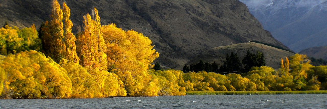
From the car park Te Araroa veers a little to the right on the track down the western side of the lake. It then exits towards the highway at the southern lakehead. There is a direction sign to a car park here. Turn left and cross the highway prior to the car park and descend on the formed track to Lake Hayes Estate, suburbia. Follow the Queenstown Cycle Trail signs along the track that skirts the estate and exits from the lower end of Widgeon Place.
Turn right and continue upstream along the track on the Kawarau River’s true left bank. This track bends around at the Shotover River confluence and leads up towards the historic Shotover footbridge, which was restored in 2005 as a Rotary Centennial Project.
Once across the footbridge take the track to the left that passes a covered picnic table before leading down towards the river. This track continues downstream and passes under the highway bridge.
Cross to the right-hand side of the road and veer right past the dog pound and the gun club. Climb the hill beside the gate to the oxidation ponds and exit through an alleyway onto Glenda Drive. Turn right onto Glenda Drive, follow that around, past Mitre 10 and continue south to the roundabout, then right onto Hawthorne Avenue out towards the main road. Before reaching the main road, turn left onto the shared cycle/walking track which takes you south towards the Five Mile shopping centre (ideal resupply point). The track continues through the Queenstown events centre and crosses the golf course onto Kawarau Road (SH6). Cross the road, turn right, then left into Ross Street. At the bottom of Ross Street turn right into Birse Street, which exits onto Lake Avenue.
The Frankton Domain is across Lake Avenue. Walk down to the lakeshore and the Frankton Walkway starts at the western end of the Domain. From here the walkway provides an easy 1 to 1½ hours of lakeside walking experience to Park Street. Continue on Park Street and then the track through the Queenstown Gardens to Marine Parade, on the lakefront, in central Queenstown.
Conditions
Potential hazards
- Vehicles on road or track
- Few water sources
- Take care on shared cycle/walkways
How to get here
Northern Start: Junction of Villiers and Buckingham Streets, Arrowtown
Southern End: Marine Parade, Queenstown
Transport
Regular flights from Queenstown to many destinations.
- Air New Zealand - P: 0800 737 000
- Jetstar - P: 0800 800 995
- InterCity - P: 03 365 1113
- Atomic Shuttles - P: 03 349 0697
Many options for car rental are available.
Accommodation
There are many options for accommodation at all levels within Queenstown. Some include
- Bungi Backpackers BBH - Cnr Sydney & Stanley St, Southern Lakes, Queenstown - P: 0800 728 286 or 03 442 8725
- Creeksyde Queenstown Holiday Park & Motels- 54 Robins Rd, Queenstown - P: 0800 786 222 or 03 442 9447 -
- E: creekyde@camp.co.nz
- Mrs Woolly's Campground (Glenorchy), 64 Oban St, Glenorchy - P: 021 088 94008 - E: info@mrswoollyscampground.co.nz
- Campsites available, and a "glamping" option. Open Nov-Apr. Kitchen, toilet/showers, laundry and a store (with free wifi).
Food And Supply
- New World Supermarket - Hawthorne Dr, Frankton, Queenstown - P: 03 442 3045
- Fresh Choice Supermarket - 64 George St, Queenstown - P: 03 441 1252
- Mediterranean Food Market - 53 Robins Rd, Queenstown - P: 03 442 4161
- Alpine 4 Four Square Supermarket - Cnr Shotover & Stanley Sts, Queenstown - P: 03 442 8961
Track Elevation and Map

Total 1 photos. Click image above to view them all.
More information
- Queenstown i-SITE Visitors Centre - Travel & Visitor Information Centre Clocktower Building, Queenstown - P: 03 442 4100 - E: info@qvc.co.nz
- Whakatipu-wai-Māori / Queenstown Visitor Centre - 50 Stanley St, Queenstown - P: 03 442 7935 - E: queenstownvc@doc.govt.nz
Before starting Te Araroa either as a through-walker of the whole country or a section walker, please register on Te Araroa website. Please also visit the website or download the app for detailed maps, trail alerts and other relevant information.
This track is part of the Herenga ā Nuku Aotearoa track database. Herenga ā Nuku has maps and advice about public access to the outdoors.
We encourage you to continue gaining the skills and knowledge required for a safe trip. The NZ Mountain Safety Council has lots of free resources and information you can use. These can be accessed via www.mountainsafety.org.nz.
We recommend trying these online learning tools:
Additionally, check out the range of helpful videos available from the NZ Mountain Safety Council YouTube channel.

Page last updated: 26/09/2025, 4:13 pm