Key landscape layers
To identify the significant cultural landscape layers in the region, DesignLab undertook a key documents review, site studies and desktop analysis. Eight significant landscape layers were identified that express both place and people, including relationships with mounga, moana, and also the stories of journeys that connect the past and future potential of this place and its people.
- Layer 1: The story of Taranaki
- Layer 2: biodiversity story
- Layer 3: Marae and pā places
- Layer 4: An active TaranakI
- Layer 5: Tourism experiences
- Layer 6: Key agencies
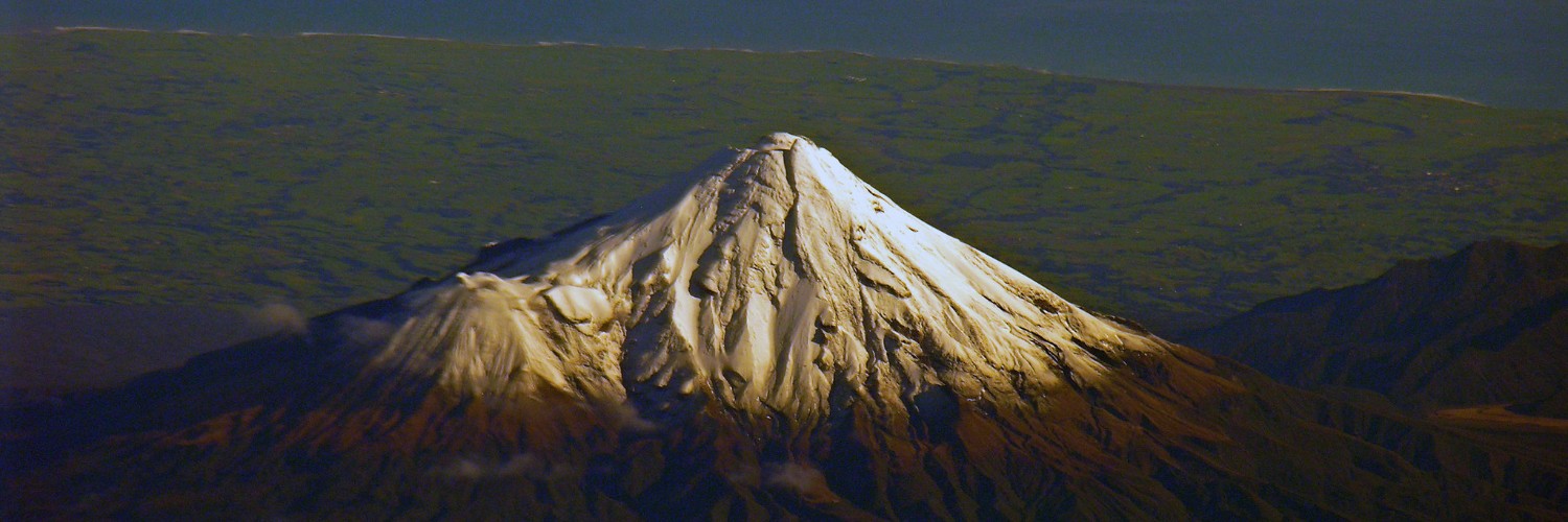
- Layer 7: The mountain: ki uta kitai
- Layer 8: Current tracks and trails network
Layer 1: sense of local identity
The story of Taranaki coming to the ocean begins with his disagreement with Tongariro, to leaving the islands center to journey down the Whanganui river, and the guiding of Taranaki by te toka-a-rauhoto to where Taranaki sits today. People came to the region, shaping the plains of the mountain to live, work and play on. In turn, the mountain shaped these people, in their everyday lives, their family’s lives, and what it means to be ‘from and of Taranaki’.
Layer 2: biodiversity story
Taranaki is undergoing a region-wide transformation. Along many of its waterways native species are being replanted to create biodiversity ribbons across the landscape, connecting the mountain’s peak to where it flows into the sea.
This transformation is being intentionally created by farmers, conservationists, and communities. And while the native vegetation within the National Park is at a fixed total of 300,000 hectares, the total native vegetation outside of the National Park has the potential to grow and eventually exceed this figure. Through the creation of Wild for Taranaki, Project Mounga and its’ partnering with NEXT foundation, Taranaki is leading the way with a nationally significant restoration regime.
Layer 3: Marae and pā places
There are eight iwi within the Taranaki area. Together, they are kaitiaki of Taranaki, the Pouakai and Patuha ranges, Taranaki’s plains, the coastal edge and seabed, as well as the many rivers, plants and fauna. Practices of kaitiakitanga, manaakitanga, whanaungatanga and mahinga kai are fundamental values for the ways people can shape and be shaped by Taranaki.
The values of Ngāruahine, Ngāti Maniapoto, Ngāti Maru, Ngāti Mutunga, Ngaa Rauru Kiitahi, Ngāti Ruanui, Ngāti Tama, Te Atiawa and Taranaki Iwi must underpin the regions Tracks and Trails strategy.
Layer 4: An active Taranaki
The region is alive with social, cultural and community events throughout the calendar year. Annual events are interspersed with events of celebration, gathering, workshops, conservation and recreation activities. Locals live, experience and interact with the mountain in their daily life.
Layer 5: Tourism experiences
Tourism and visitor opportunities related to Taranaki are strongly represented in visual material such as booklets, brochures, and online material. Likewise, a range of activities across the region and around the mountain are digitally accessible through visitor sites including Trip Advisor and Google.
To improve what can appear as a mix of ‘could-be-worthwhile’ experiences, there is considerable opportunity to structure existing visitor nodes within a narrative of regional-scale journeys.
Layer 6: Key agencies
The region is strongly represented through its three district and one regional council, eight iwi and also government agencies that includes the Department of Conservation. Here there is greater opportunity for coming together around the shared mana of the mountain, in that while New Plymouth District Council, South Taranaki District Council and Stratford District Council work across their respective boundaries, the top of the mounga once within the National Park area is principally left for the Department of Conservation to manage.
There are opportunities to further align common values, and foster investment and development across margins in a shared vision for people and place.
Layer 7: The mountain: ki uta kitai
The mountain’s layers are rich in social, cultural, historical, temporal, and ecological values. These layers do not stop at the national park boundary, and instead are strongly represented along a ‘ki uta ki tai’ transect from peak to foreshore and seabed.
Layer 8: Current tracks and trails network
There is a desire by communities to develop and/or maintain many of the tracks and trails in their area. Region-wide maintenance and track documentation can further support this opportunity for communities to be involved in maintaining access in their landscape. Wayfinding and coherence can be strengthened through:
- A communication strategy that brings together a shared expression of values, connections and journeys across boundaries
- Itineraries that are multi-stops, multi-days, multi-experiences