Photo by
Brendan Pheasant
This track was made around 1910 by road workers using wheelbarrows, picks and shovels.
The Rerekapa Track starts at Kiwi Road and crosses open farmland then turns left across Blacketts Creek.
The track skirts the base of the ridge and winds to the top of a low saddle then down through undisturbed tawa/kamahi forest into the valley. There have been sightings of kōkako in this area.
The Rerekapa Hut is nearby. This basic backcountry hut is privately managed but is available for public use. Contact Rerekapa Hut Supporters Incorporated, phone +64 6 754 6005 for details of fees and bookings.
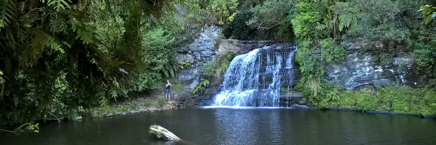
The track reaches a boundary fence and crosses a farm, following the fence to a former homestead site and the 10 m high Rerekapa Falls (2 hr 45 min from Kiwi Road).
Beyond the farm buildings the track re-enters the Moki forest which, on this section of the track has been logged but not cleared.
The track finally emerges on Mangapapa Road, which links Moki and Okau Roads and is part of the historic Stratford/Taumarunui Heritage Trail (The Forgotten Highway). Either arrange to have a car waiting at Mangapapa Road, or return to Kiwi Road (3.5 hr).
Dogs with a DOC permit only. Contact the relevant DOC office to obtain a permit.
The track is closed from 1 August to 31 October every year for the lambing season.
This track is located 68 km north of New Plymouth. Turn of at Uruti onto Uruti Road, then Moki Road. Turn left onto Kiwi Road, the track starts 12 km onlong on the right. Please park your car on the roadside. More detailed information about the area can be found on map NZTopo50 sheet BH31.

This trail currently has no photos.
