Photo by
Pierre Roudier
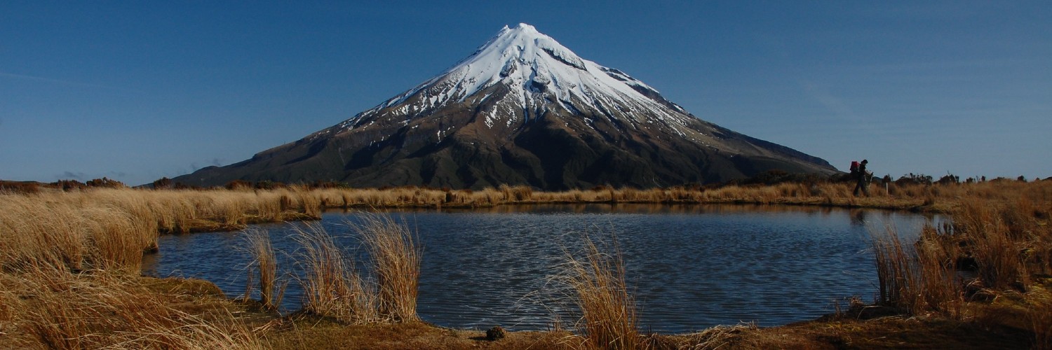
Visit the Pouakai Tarns and Mangakotukutuku Falls while exploring the rugged range of rolling hills covered in subalpine bush.
Time: 1.5 hours one way
Distance: 2.3 km to the waterfall
From the road end the track crosses farmland to the boundary of Egmont National Park.
From here it climbs a spur on the Pouakai Range, arriving finally at the Mangakotukutuku Falls.
A Māori oven can be found just below the junction of the Falls track on the true left side. Care must be taken not to disturb this archaeological feature.
When crossing farmland please respect private property, leave gates as you find them and stay on the route.
Getting there: Follow Kent Road from State Highway 3 south of New Plymouth. Turn right onto Maude Road and follow it to the end. Limited car parking available.
Time: 4 to 5 hours return or overnight
Distance: 5 km to the hut
From the car parking area walk up the driveway, turning left at the water tank and heading into the bush.
The track climbs steadily up many steps to the 16 bunk Pouakai Hut. Walk five minutes past the hut for great views down over Ahukawakawa Swamp.
From here turn left at the track junction to access the Pouakai Tarns (pools) – a further 10 minutes walk along the Pouakai Track.
This is a good short day tramp, or you can stay overnight at Pouakai Hut.
Getting there: The track begins at the end of Mangorei Road, New Plymouth. Limited car parking available on the roadside.
Time: 4 to 5 hours one-way or overnight
Distance: 7.8 km to the hut
From the track entrance, this challenging track climbs steeply to an exposed spur leading up to Pouakai Trig.
From here the track descends to the Pouakai Track junction and on to meet the Mangorei Track junction.
Turn downhill here for a 5-minute walk to Pouakai Hut.
Expect overgrown sections, tree windfalls and some scrambling over rocky outcrops.
No dogs. Sections of this track can become impassable in winter conditions due to snow and ice. Check with Egmont National Park Visitor Centre for up to date track conditions.
Getting there: The track begins at the end of Carrington Road, New Plymouth (opposite Dover Road junction). Park on the roadside.

This trail currently has no photos.
https://www.doc.govt.nz/parks-and-recreation/places-to-go/taranaki/places/egmont-national-park/things-to-do/tracks/pouakai-range-tramping-tracks/
This track is part of the Herenga ā Nuku Aotearoa track database. Herenga ā Nuku has maps and advice about public access to the outdoors.
We encourage you to continue gaining the skills and knowledge required for a safe trip. The NZ Mountain Safety Council has lots of free resources and information you can use. You can access them at www.mountainsafety.org.nz.
We recommend trying these online learning tools:
Additionally, check out the range of helpful videos available from the NZ Mountain Safety Council YouTube channel.
