
Pirongia to Waitomo
-
Walking
Te Araroa trail section: Travel over farmland, an airstrip, old logging routes and lush forest, with some great views on the way.
This is a sometimes steep, rough tramping track with some backcountry road walking.
Pirongia to Waitomo - 45km
From the Omanawa Stream, follow Pirongia West Road in a southerly direction. After 2km, you'll reach the intersection with Pekanui Road. Cross over it and continue south/southwest along Te Rauamoa Road. After 5.5km, you'll reach SH 31/Kāwhia Road. Turn southeast (left) and follow it 2.7km and turn southwest (right) into Kaimango Road. Follow Kaimango Road for 7.5km to reach the intersection with Honikiwi Road.
At Honikiwi Road veer west (right) to remain in Kaimango Road and walk another 200m to the small carpark and stile on the south (left) side of the road.
Cross the stile onto a formed farm road and follow the orange markers. Then 2km after the rural airstrip, look out for double orange markers. It is not obvious but the track goes over a stile here (while the farm road continues on) and into a bush track on an old timber trail.
Keep following the orange markers over high point #405 and past #513 – Omaru, and through to a woolshed near the north end of Māhoe Road.
Take the gravel Māhoe Road which extends beyond the woolshed, and keep heading south 500m past a Department of Conservation sign; "Ōmaru Scenic Reserve".
Caution: on the bush track and gravel road from km 867.9 to km 873.4 hikers should be aware of nighttime pest control using firearms. Camp only at Putaki Shelter, a large, red half-round barn with rainwater and toilet at km 871.8, or at DOC's Omaru Scenic Reserve on the Old Putaki School Site Memorial Rock at km 872.7 km
From the Mahoe Rd sign and gate at km 873.4 the trail is on NZCF land until the 875.9 Exit Gate - also strictly no camping or fires
The route heads due east following a fence line, with a couple of up and downs and small waterway crossings, however these can be crossed easily.
1km in, you will encounter a grass airstrip. It will likely not be in use, however, please take caution. If the airstrip is in use, do not cross until invited, please note as below:
This airstrip is a high-risk area. If the airstrip, and/or the fertiliser shed adjacent, is in use – wait where the signs indicate, attract the attention of the site manager, and await their instruction to cross.
After crossing the airstrip, continue along the marked fence line some 400m, which eventually joins a graded track. Follow the track 700m until a stile takes you across a fence and into a neighbouring property. The route continues to follow a fence line 1.5km through cut scrub until crossing another stile by the edge of more mature forest.
A lovely walk through the forest follows – navigate carefully the first 500m along the ridge, then it is slippery when wet on the downhill slopes. There is a crossing of the Moakurarua Stream partway along the track. In "normal" weather, the stream will be no deeper than knee height but can rise after heavy rain. Be prepared to wait it out and if that's the case, it is recommended that you head north back along the track to higher ground.
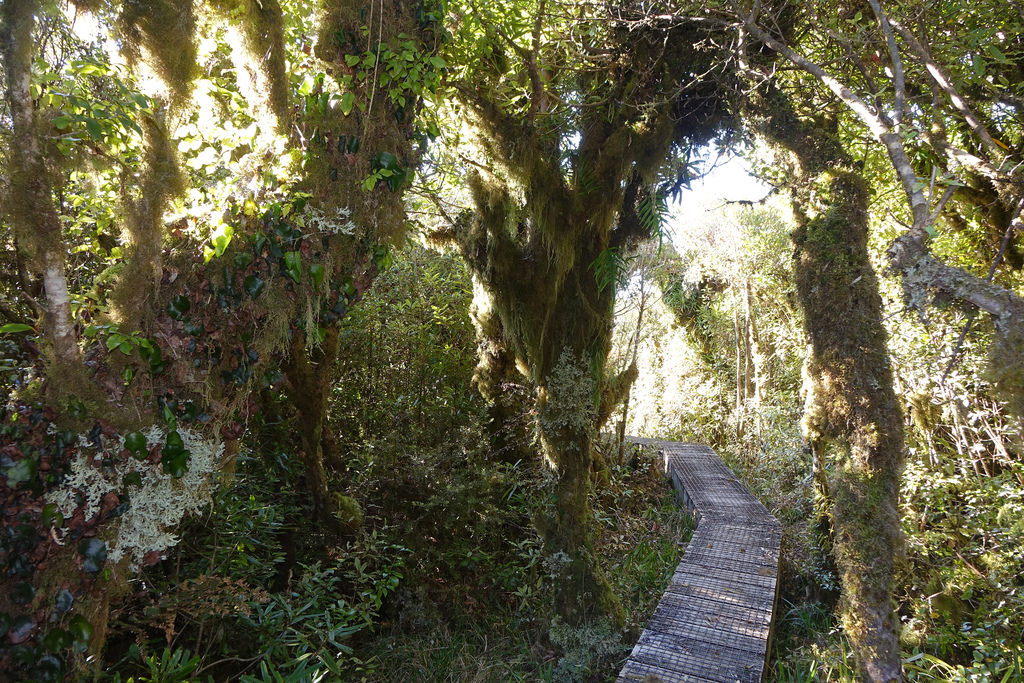
Once you are over the stream, there is a gentle uphill before entering a track - lookout for the markers on the right. The track is based on the old logging routes, note the hand-formed rock cuttings. Occasionally you'll get a good view out across the forest.
Follow the markers through to the northern end of Ngatapuwae Road.
Walk (approx. 2.5km) the length of Ngatapuwae Road (south/southeast) into Te Anga Road. Down the hill and just before the roundabout intersection, it joins up (to the right) with DOC's Waitomo Walkway which follows beside the Waitomo Stream through a mixture of shady forest and open farmland. Turn east and follow the track into Waitomo Village. (Note: The Waitomo Walkway crosses Te Anga Road, so it is possible to walk the final 1km to Waitomo Village along the road).
Conditions
Potential hazards
- Vehicles
- Farming operations - Leave gates as you find them
- River crossings - never cross flooded rivers - one stream before connection with Ngatapuwae Road is dangerous after heavy rain
- Respect private land
- NO dogs, camping or fires.
- This is a sometimes steep, rough tramping track with some back country road walking.
- Caution: on the bush track and gravel road from km 867.9 to km 873.4 hikers should be aware of nighttime pest control using firearms. Camp only at Putaki Shelter, a large, red half-round barn with rainwater and toilet at km 871.8, or at DOC's Omaru Scenic Reserve on the Old Putaki School Site Memorial Rock at km 872.7 km
- Caution: The airstrip is a high risk area. If the airstrip, and/or the fertiliser shed adjacent is in use - wait where the signs indicate, attract the attention of the site manager, and await their instruction to cross. DO NOT cross until invited.
- Note: that just before Ngatapuwae Road (when tramping south) you have to wade the Moakurarua Stream. The crossing here is unsafe when in flood, so do not attempt the Māhoe Road to Ngatapuwae Road when there's been persistent rain in the area.
How to get here
Northern Start: Junction of Pirongia West Road with Omanawa Stream
Southern End: Waitomo Walkway carpark, Waitomo Village
Transport
- InterCity - P: 07 348 0366 - E: info@intercity.co.nz
Accommodation
South of Pirongia
Trail Hosts
- Jo's Funny Farm. 10yrs a Trail Angel. A great stop after a muddy mountain descent, rest & refuel before a long section to Waitomo. 60m from the Kawhia Road, Kaimango Road intersection at km 855.7. Follow the signs from Kaimango Road (Trail Angel Way) intersection. Signs are at my gate. Plenty of room. Tent sites & indoor beds available, shower, dinner and breakfast options to choose from. Prices at the gate. Vegetarian options available but sorry, no vegan. Comments can be found on FarOut app at the Kawhia, Kaimango Rd intersection spot. Txt Jo with number of people who want to stay 022 013 5713 or call 07 871 0601. Phone service can be irregular so if you don't get a reply from me, come on in anyway.
-
Putaki Campsite, Mahoe Road, km 871.8. Campsite with shelter and toilet (under construction April 2025). Provided by Te Araroa Waikato Trust with support from NZ Carbon Farming
Waitomo
- YHA Waitomo - 600 Waitomo Caves Road, Waitomo P: 07 878 7649 E: waitomo@yha.co.nz
- Waitomo Village Chalets & Kiwipaka backpackers - Hotel Access Rd, Waitomo - P: 022 641 5143 - E: stay@waitomochalets.com
-
10% Discount for all Te Araroa walkers on accommodation plus $10 Continental breakfast (Normally $20). We have onsite laundry and plenty of relaxing space in our shared dining and kitchen areas! Ask our amazing staff for anything and they’ll do their best to help
-
- Waitomo Top 10 Holiday Park - 12 Waitomo Village Road, Waitomo - P: 0508 498 666 freephone or 07 878 7639 - E: stay@waitomopark.co.nz
- Waitomo Caves Hotel - Hotel Access Rd, Waitomo - P: 07 878 8204 - E: info@waitomocaveshotel.co.nz
- Hamilton Tomo Group - 155 Te Anga Rd - On the trail route 1.5km before Waitomo Village - Friendly caving club hut with plenty of bunk rooms, free hot showers, kitchen and large communal sitting room with wood burner and large deck. There is also space on the grounds for camping and outbuildings for drying gear. - $25pp/night for a bunk or for camping - Booking is via www.htg.org.nz
Food And Supply
- The Waitomo Glow worm Caves Visitor Centre - 39 Waitomo Caves Rd, Waitomo - P: 07 878 8227 or 0800 456 922 freephone. Also includes a Restaurant and café.
Track Elevation and Map

Total 1 photos. Click image above to view them all.
More information
Before starting Te Araroa either as a through-walker of the whole country or a section walker, please register on Te Araroa website. Please also visit the website or download the app for detailed maps, trail alerts and other relevant information.
This track is part of the Herenga ā Nuku Aotearoa track database. Herenga ā Nuku has maps and advice about public access to the outdoors.
We encourage you to continue gaining the skills and knowledge required for a safe trip. The NZ Mountain Safety Council has lots of free resources and information you can use. These can be accessed via www.mountainsafety.org.nz.
We recommend trying these online learning tools:
Additionally, check out the range of helpful videos available from the NZ Mountain Safety Council YouTube channel.

Page last updated: 6/11/2025, 9:09 am