Photo by
Ian Munnings
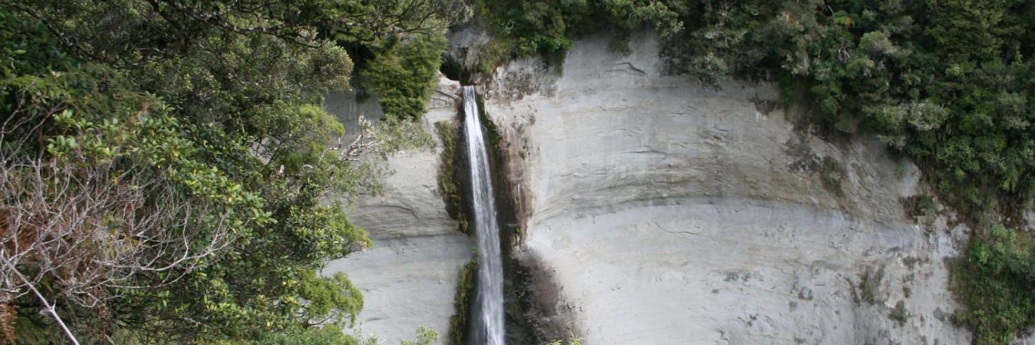
At 74 m high, Mt Damper Falls is one of the highest waterfalls in the North Island.
From the car park, step over the style and walk over the formed track beside the creek.
The first 10 minutes are over open farmland — respect private property, leave gates as you find them and stay on the track.
Follow the track until you reach the bridge, from where the bush starts. The track descends gradually to two viewing platforms.
Dogs with a DOC permit only. Contact the relevant DOC office to obtain a permit.
The track is closed to hunters every year from 1 August to 31 October for the lambing season.
The walk starts from Mt Damper Falls car park, on the Okau Road off SH3, 59 km north of New Plymouth.

This trail currently has no photos.
This track is part of the Herenga ā Nuku Aotearoa track database. Herenga ā Nuku has maps and advice about public access to the outdoors.
We encourage you to continue gaining the skills and knowledge required for a safe trip. The NZ Mountain Safety Council has lots of free resources and information you can use. These can be accessed via www.mountainsafety.org.nz.
We recommend trying these online learning tools:
Additionally, check out the range of helpful videos available from the NZ Mountain Safety Council YouTube channel.
