Manawa Karioi - Moemoeā
-
Walking
-
Dog Friendly
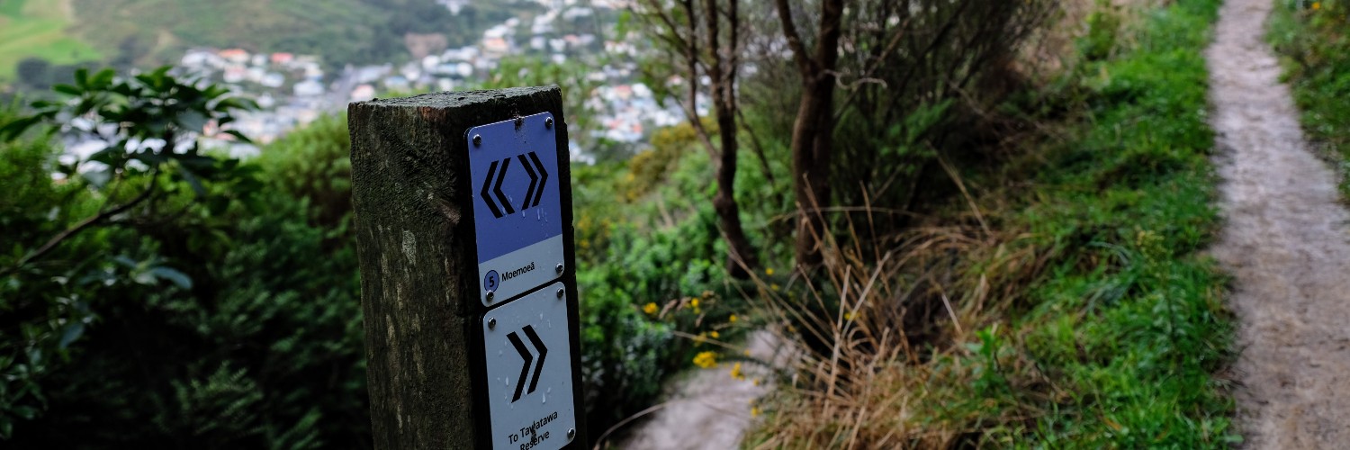
In the process of making new signs, Manawa Karioi was been given new track names from the whānau at Tapu te Ranga Marae. The Tapu te Ranga Trust would like Manawa Karioi to be used and enjoyed by everyone. Moemoeā - To have a dream, to have a vision: From this highest track you can look out across the land and see the fruition of dreams past or dream new dreams of your own.
In the process of making new signs, we have been given new track names from the whānau at Tapu te Ranga Marae. The Tapu te Ranga Trust would like Manawa Karioi to be used and enjoyed by everyone. Moemoeā - To have a dream, to have a vision: From this highest track you can look out across the land and see the fruition of dreams past or dream new dreams of your own.
Conditions
- Smoking and fires are prohibited at all times
- Dogs should be under control; please keep on a lead near marae buildings and their surrounds. Remove dog litter
- Keep to the tracks and clearings shown on the map
- Some track surfaces are uneven
- Sturdy footwear is recommended
- Children must be supervised at all times.
- All rubbish must be removed
- Motor vehicles are prohibited
- Safety notices must be obeyed
- Do not interfere with plants, animals, traps, bait stations, markers or other objects (visitors are permitted to collect plant material from track-sides for uses such as food, medicine or propagation, provided it is for small-scale personal use)
- If you notice any hazards, please let Manawa Karioi know.
How to get here
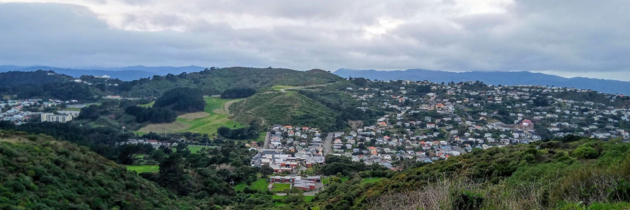
Manawa Karioi has an extensive network of tracks. It has just over 5 km of tracks that can be accessed from Tapu te Ranga Marae with other access points from the end of Rhine St, Tawatawa reserve/City to Sea Walkway, and the Berhampore golf course.
Transport
Accommodation
Food And Supply
Track Elevation and Map

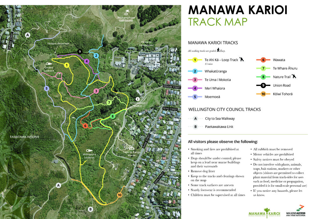
Total 3 photos. Click image above to view them all.
More information
- Other Manawa Karioi tracks
- $5,000 grant to build signs on Manawa Karioi tracks
- Chris Livesey talks about new signs for Wellington's Manawa Karioi trails
This track is part of the Herenga ā Nuku Aotearoa track database. Herenga ā Nuku has maps and advice about public access to the outdoors.
We encourage you to continue gaining the skills and knowledge required for a safe trip. The NZ Mountain Safety Council has lots of free resources and information you can use. These can be accessed via www.mountainsafety.org.nz.
We recommend trying these online learning tools:
Additionally, check out the range of helpful videos available from the NZ Mountain Safety Council YouTube channel.

Page last updated: 23/09/2025, 3:33 pm