Govan Wilson to Puhoi Valley
-
Walking
Te Araroa section: Puhoi is situated on the beautiful Puhoi River and is one of New Zealand’s historic villages. It was originally settled in 1863 by immigrants from Bohemia, an area which is now the Czech Republic—situated 40km north of Auckland and the gateway to Matakana Coast and Country.
Govan Wilson to Dome — 15km / 6-7 hours
- Warning: this track crosses private forestry land in the Waiwhiu Valley. Open daylight hours only — no camping, fires, dogs, horses, or vehicles.
Walk 3km to the end of Govan Wilson Road to the marked steps up onto the track
Once up the steps from Govan Wilson Road, follow the clay four-wheel drive track. It passes a private home, so please keep to the track. Enjoy the views and the rusty old bus while following along the ridge to the junction with Conical Peak Road.
The house owners provide a basic tent site. A compost toilet and some water may be available. The entrance gate is on the right, a little further down to road past the old boat, at km 507.3
Just before reaching Conical Peak take the right fork off the gravel road and continue on this 4WD clay track until reaching a turnoff on the left onto a narrow bush track in DOC’s Tōtara Scenic Reserve.
At km 509 there is a trail junction. The Te Araroa route branches off to the left.
An alternative route continues on the 4WD track to the right, labeled Govan Wilson Rd - Dome Track Bypass on older maps), DO NOT use this bypass. New forestry work in October 2024 uses the road part at the lower end of the bypass, making it dangerous
Follow the marked bush track, which eventually descends steeply down the ridge into the Waiwhiu Valley. At the bottom of the hill, the track turns right across a small creek and follows the true right of the Waiwhiu Stream for approximately 1.3 km. At this point the track crosses the stream over rocks (take care not to slip) to enter private forestry land. This crossing can become deep after prolonged heavy rain. If it is too dangerous to cross it is possible to continue west on the true right of Waiwhiu stream almost 1 km to reach a concrete ford. There is no clear track to the ford and this alternative should only be attempted if the stream crossing is not possible,
DOC has installed a long drop toilet between the Waiwhiu Stream crossing and Waiwhiu Valley Road, km 512.1.
The track joins the Waiwhiu Valley Road, a private forestry road. Turn right and follow the road for approx 300m. Turn left onto a gravel 4WD forestry road (Fisher Road — however, signage may be removed).
Fisher Road climbs steeply through pines. Just over the hill’s highest point, the track turns right off the 4WD road (now signposted) into the pines for a short climb to the ridgeline and DOC’s Dome Forest.
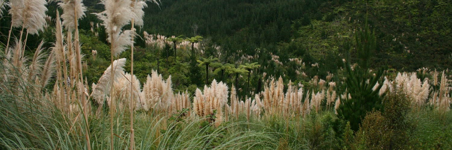
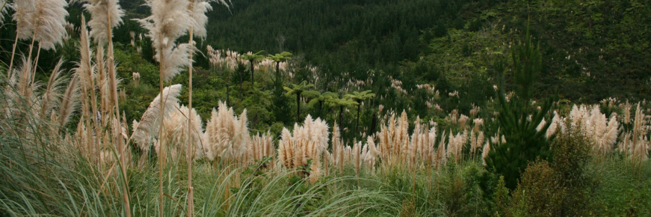
This narrow bush track now follows along the ridgeline through attractive podocarp and broadleaf forest with glimpses of the surrounding countryside and coast.
The track climbs to the Dome trig. Then there are a few more ups and downs along the ridge, including a steep scramble around large rocks, on the way to the lookout platform with views across the Mahurangi Peninsula to the Hauraki Gulf. The track then descends 1km on an upgraded walkway and steps to the Dome Cafe carpark and SH1. The former Dome Cafe is now a private residence, but the owners are generously providing a campsite for Te Araroa walkers. There is a new drinking water tap and Te Araroa hikers are allowed the camp on the small grass area behind the former cafe buildings. Please take care and be considerate of the owners who are continuing to develop the property as their home, with provision for Te Araroa walkers. There is a toilet accessible around the right side of the shelter where an outdoor kitchen is under construction.
Dome to Moirs Hill — 16.5km / 4-5 hours
- Warning: Forestry and farming operations
- SH1 is a busy road. The crossing has been modified to make it safer but take care as motorists may not be expecting pedestrians crossing
Immediately across SH1 from the Dome Cafe is Kraack Road. Follow this road up to a forestry gate. Pass the gate and head along a southwest forestry road. Take a left down another track heading southwards, then cross westwards through regenerating native bush. Follow the track through Smyth Bush Reserve to Smyth Road.
Follow Smyth Road south, turn right into Kaipara Flats Road, then left into Streamlands/Swamp Roads.
Turn right (west) into Old Kaipara Road and keep an eye out for the entrance to #121 when the route is marked up the driveway. Follow the markers up the driveway and around the edge of a fence (not up the driveway to the house), then follow the marked fenceline up to and along the ridge to Edgerley Road; please use the stiles. Give stock a wide berth — they are very friendly.
Follow Edgerly Road for 1km before turning right (west) onto Woodcocks Road. A further 500m along, take a left into Matthew Road and follow it for 1 km. Running off the end of Matthew Road is a forestry road to bring you up to the summit of Moirs Hill. As the forestry track runs onto Moirs Hill Road, continue straight ahead past DOC’s Waihunga Track and the radio transmission tower shortly after. Take care along Moirs Hill Road as forestry trucks may be working and the winding road limits visibility. Do not walk this road with headphones on.
A gate and Private Property sign block vehicle access to the forestry road at the end of Matthew Road. Te Araroa walkers are welcome to squeeze around the gatepost on the left end of the gate and continue up the hill, following the forestry road.
Moirs Hill to Dunns Bush - 2.5km
Just east of the transmission tower is a Te Araroa-signed track that heads 1.7km south down to Ahuroa Road at km 537.1. Signage indicates 5 km to Remiger Road and 9.5 km to Puhoi.
Note: stay on the clay/grass track. The gravel track you may see occasionally is a neighbouring forestry road. There are few markers as there is just pine and gorse for much of the way.
Cross Ahuroa Road, straight ahead into J Tolhopf Road. A grass track following the power poles provides a safer shortcut, bypassing the first 100 m of J Tolhopf Road. Had south 1km down, and then up, J Tolhopf Road until you pass a rural residential subdivision, then reach a widened area of the sealed road with car parking. Enter through the gate just past the carpark, and follow the fenceline up and over the ridge to the bushline.
Dunns Ridge Track — 3.5km / 1 hour
- Warning: Farming operations and predator control — please do not freedom camp in this area. Predator control may include hunting wild goats and pigs.
From this bushline, follow orange markers across and through part of Dunn’s Bush (a Queen Elizabeth II National Trust reserve, with loop tracks back to Ahuroa Road) until you pass the “Sugarloaf” rock formation. A stile is in place if you want to climb up to this very peaceful and picturesque spot with beautiful views across the valley and out to the coast. Take care at the end of Dunn's Bush. Te Araroa continues ahead over grassland. Do not follow DOC arrows for an alternative track turning downhill to the left.
Otherwise, keep heading southeast on the ridge and follow markers through the farm paddocks. The route briefly joins a farm track and then leaves it again to follow the fenceline — please stick strictly to the marked route and follow the fenceline, descending steeply to Remiger Road.
On reaching Remiger Road turn right and cross the bridge over a small creek. On the left, the Remiger Road Conservation Area (km 541) offers free camping with a small shelter, picnic tables, water supply (treatment recommended) and a toilet. Camp on the grass near the shelter, avoiding the young trees and shrubs planted to enhance this DOC site.
Follow Remiger Road 1km to the intersection with Ahuroa Road. Directly opposite there was previously a swing bridge onto the Puhoi Track. The bridge was destroyed in the flooding and storms in January 2023. An alternative crossing point, starting on the other side of the concrete road bridge to your left and fording the smaller stream, has been developed to connect to the original track at km 542
Conditions
Potential hazards
- Vehicles on road or track
- Poisons & traps
- Farming operations
- Forestry operations
- River crossings - Never cross flooded rivers
- Small stream crossings
- Track exposed to sun, wind or cold
- Few water sources between Dome and Puhoi
No dogs allowed
For tramping tracks, it’s recommended you carry appropriate safety gear including a map, compass, whistle, warm clothing, raincoat, basic medical kit, strong footwear, food and water. Cellphones can work on the ridgelines.
How to get here
Northern Start: Junction of Govan Wilson and Matakana Valley Road
Southern End: Junction of Ahuroa and Remiger Road, Puhoi
Transport
Getting there/away
Long haul bus services stop 9km away at Warkworth, the nearest town on SH1.
- InterCity - P: 09 583 5780 - E: info@intercity.co.nz
- Northliner Express Coach Service - Paihia - Auckland - Wellington - P: 09 438 3206
- Naked Bus - P: 0900 62533 (calls cost)
Local transport/transport to the trailhead
- Warkworth Taxis - 54 Burtram St, Warkworth - P: 09 425 0000
- Matakabs - P: 09 422 2244 or 0800 522 743
Accommodation
Trail Pass
![]() Remiger Road Campsite - km 540.97 - Included in The Trail Pass
Remiger Road Campsite - km 540.97 - Included in The Trail Pass
Other Accommodation
Govan Wilson Trail Hosts
- Twin Rimus (Matt and Jas) - Cottage for rent at 107 Govan Wilson Rd. Book in advance through airbnb https://abnb.me/EwAdz3J67lb or https://www.airbnb.co.nz/rooms/18696367
- There is a basic campsite at km 507.3 Govan Wilson Road and Conical Peak. The owner supplies water and a composting toilet. $20 donation expected
Dome Cafe Trail Hosts
- The old Dome Café at km 519.2 is no longer open as a cafe. Te Araroa walkers are permitted to camp on the small grass area behind the cafe buildings. Please take care and be considerate of the owners who are continuing to develop the property as their home, with provision for Te Araroa walkers. There is a drinking water tap and a toilet in the main cafe building, accessed by walking around the deck.
Dome to Moir Hill
- Sheepworld Cafe and campsite is 2 km south of the closed Dome Cafe on SH1. Sheepworld Campground is open and available to Te Araroa walkers to camp overnight for a small fee. Walkers can go to our website at www.sheepworldcamp.co.nz to check availability and book a site. Fees are generally $20pp/night. Your host is Ian and his contact number is 09 425 9962. We are located at 324 State Highway One, Dome Valley.
Dome to Moir Hil Trail Hosts
- Kraak Road. 1.7 km uphill from the highway crossing, just before reaching the forestry gate, there a small, tidy campsite provided by the farmer. Drinking water is available from a tap beside the doors on the green barn across the driveway. Please respect that this is a limited water supply from a rainwater tank. The resident who depends on it has expressed concern that hikers are using it for washing and the tank may run dry in summer.
Please ring, txt or what's app Roma on 021759991
- 396 Moir Hill Rd - Just several hundred easy meters off Te Araroa, The Woolshed is the perfect place to get out of the weather. With plenty of space for large groups inside, a fire to dry out and warm up, free wifi, bunks, beds, large couches, filtered drinking water, a flush toilet, unlimited camping with sweeping views over the Hauraki Gulf and Coromandel back into the city, it’s a great stop just off trail. Hosted by Stu Bennett, Te Araroa hiking alumni. Koha, ph 0274477159. I also can assist in brutal pack shake downs, reducing pack weight, and motivational chats about how you have only just started and how the best is yet to come.
Warkworth
- Walton Park Motor Lodge - 2 Walton Ave, Warkworth - P: 09 425 8149 - E: info@waltonpark.co.nz
- Ribbonwood B&B - 7 Thompson Rd, Warkworth - P: 09 422 2685 - E: berris@ribbonwoodwarkworth.co.nz
Warkworth Trail Hosts
- Trail Host, Warkworth - Carolyn and John Caukwell Phone or WhatsApp 021 274 1724. Share our home/pitch your tent, and recharge. Hot tub, dogs and cat available to walkers. May be able to collect from Dome. Max 6 walkers per night
- Todd & Kip. Trail Hosts. Plenty of room to pitch tents but anyone is welcome to a spare bed and a hot shower when available. Happy to pick up from the dome. LGBTQ friendly. Txt or call Todd on 021 654 043
Detour option for accommodation - 2 km south
Warkworth Sheepworld Caravan Park - Cabins and camping - SH 1, Dome Valley, Warkworth - P: 09 425 9962
Food And Supply
New World Supermarket - 6 Percy St, Warkworth - P: 09 425 1040
Track Elevation and Map

Total 1 photos. Click image above to view them all.
More information
Visitor information
- Warkworth i-Site Visitor Information centre - 1 Baxter St, Warkworth - P: 09 425 9081 - E: info@warkworthnz.com
- DOC - Unit 12, 30 Hudson Rd, Warkworth - P: 09 425 7812
Before starting Te Araroa either as a through-walker of the whole country or a section walker, please register on Te Araroa website. Please also visit the website or download the app for detailed maps, trail alerts and other relevant information.
This track is part of the Herenga ā Nuku Aotearoa track database. Herenga ā Nuku has maps and advice about public access to the outdoors.
We encourage you to continue gaining the skills and knowledge required for a safe trip. The NZ Mountain Safety Council has lots of free resources and information you can use. These can be accessed via www.mountainsafety.org.nz.
We recommend trying these online learning tools:
Additionally, check out the range of helpful videos available from the NZ Mountain Safety Council YouTube channel.

Page last updated: 25/04/2026, 1:07 pm