Boundary Stream Walkway
-
Walking
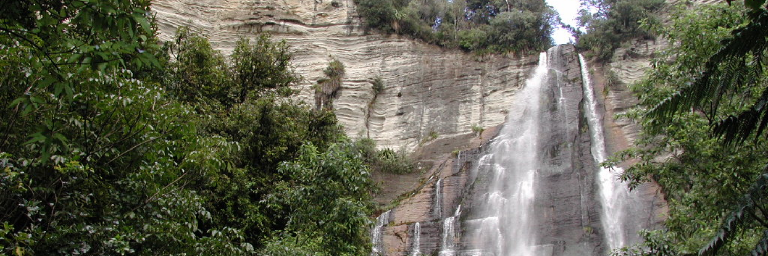
Boundary Stream Walkway is located 60km north of Napier. It passes through scenic reserve and farmland, taking in native forest and sandstone bluffs and the Hawke’s Bay’s highest waterfall, Shines Falls.
The area is home to a diverse range of native birds including the North Island brown kiwi, kaka, kokako, NZ falcon and kereru. Large populations of more common species including tui, bellbird, whitehead and North Island robin are also present. Threatened plants such as kakabeak and yellow-flowered mistletoe may be spotted by the keen-eyed.
Conditions
Some sections of this walkway cross private land and visitors are asked to stick to the marked route, respect all signposted conditions of access.
How to get here
Boundary Stream Walkway is 60km north of Napier. It can be accessed from Pohokura Road, at its western end, or Heays Access Road, at its eastern end.
Transport
Accommodation
Food And Supply
Track Elevation and Map

No photos!
This trail currently has no photos.
More information
This track is part of the Herenga ā Nuku Aotearoa track database. Herenga ā Nuku has maps and advice about public access to the outdoors.
We encourage you to continue gaining the skills and knowledge required for a safe trip. The NZ Mountain Safety Council has lots of free resources and information you can use. These can be accessed via www.mountainsafety.org.nz.
We recommend trying these online learning tools:
Additionally, check out the range of helpful videos available from the NZ Mountain Safety Council YouTube channel.

Page last updated: 26/09/2025, 12:30 pm