
Photo by
Roger Fraser
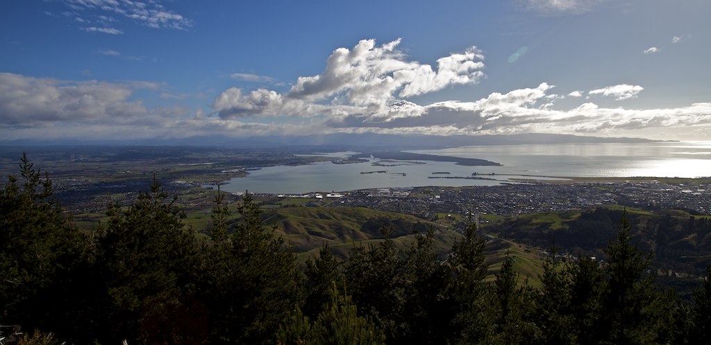
This is a loop track through an area of pine forest on Barnicoat Hill, named after early Nelson surveyor John Wallis Barnicoat. It is steep in sections, but rewards walkers with spectacular views over Mt Richmond Forest Park and Tasman Bay.
The walkway leads off across a footbridge on the right and climbs up to join the 4WD track. About 10 minutes up the track, the walkway diverts off to the left up a steep slope. Continue on through the pine forest. There are good views over the Ngawhatu Valley and out to Monaco. The track comes out by power lines, and curves around the side of the hill to the right. The straight-ahead option takes you on to Jenkins Hill.
Walk along the hillside, taking the left option where the road forks, until you come to the signpost indicating the paragliding area — this hill has great thermals and excellent flying conditions. The view off to the west is of the Richmond Range, from Dun Mountain in the east, then Fishtail, Mount Fell, Mount Richmond, Starveall and the pointy little ‘Bishop’s Cap’.
After you’ve rested and enjoyed the view, head straight ahead down the hill to join the road and take a left to return back down to the walkway start.
The hill is also popular with paragliders, who can sometimes be seen launching themselves from the nearby signposted paragliding area.
Dogs allowed on a leash.
This walkway is shared by walkers and mountain bikers, and users should respect one another.
Barnicoat Walkway can be accessed from Marsden Valley Road, in Stoke, near Nelson. Parking is available at the walkways entrance, past the cemetery.

Total 1 photos. Click image above to view them all.
This track is part of the Herenga ā Nuku Aotearoa track database. Herenga ā Nuku has maps and advice about public access to the outdoors.
We encourage you to continue gaining the skills and knowledge required for a safe trip. The NZ Mountain Safety Council has lots of free resources and information you can use. These can be accessed via www.mountainsafety.org.nz.
We recommend trying these online learning tools:
Additionally, check out the range of helpful videos available from the NZ Mountain Safety Council YouTube channel.
