Macetown road
Progress is being made on one of New Zealand’s oldest longstanding and colourful public access cases.
Some of our cases have been on our books for many years. Resolving public access can often be a long and careful process. However, few issues have been around as long as attempts to secure access along Macetown road, winding into the hills above Arrowtown. The road provides access to the Macetown Historic Reserve and other open spaces which many groups use for swimming, walking, hiking, mountain biking, horse riding, 4WDing and other activities.
For several years, we have been working with the Department of Conservation (DOC), Queenstown Lakes District Council (QLDC), LINZ the pastoral lessee, Soho Property Ltd the holder of pastoral leases over the area and QEII National Trust who hold protective covenants (The Mahu Whenua covenants) over Coronet Peak, Glencoe and Mt Soho Stations and community recreation groups to ensure public access along the road while protecting the environment.
But this discussion is just the latest iteration in over a hundred years of efforts to secure access along the road. The road has never been gazetted as a legal road, and therefore legal public access along it has never been secure.
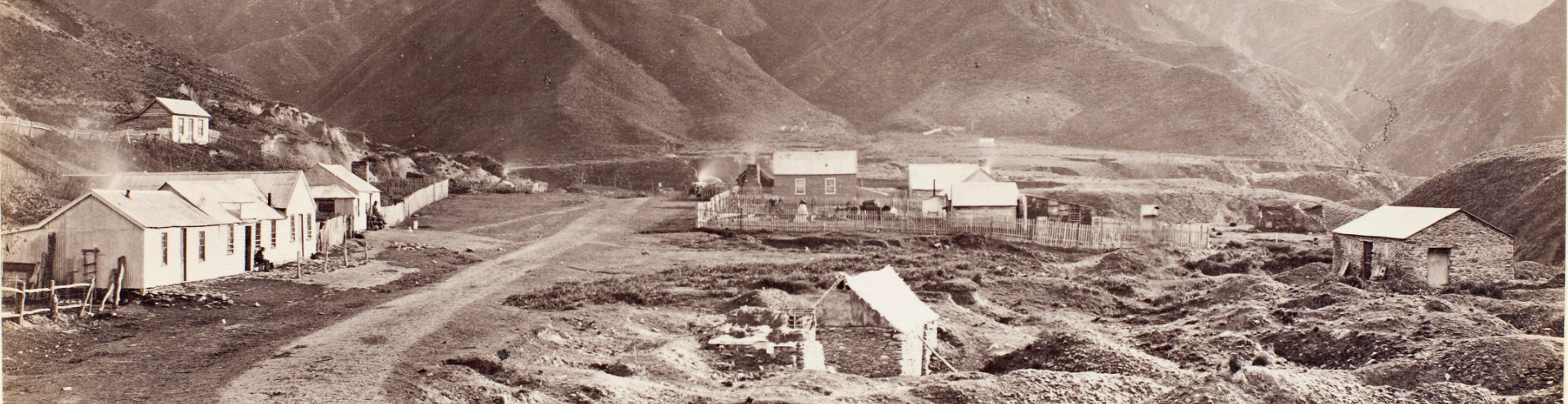
Nowadays, Macetown is uninhabited. It was also uninhabited in 1862 when a Māori shepherd, Jack Tewha (Ngati Mutunga, Te Atiawa), discovered gold in the Arrow River. By the end of that year, though, an informal road was taking 1500 miners along the Arrow River from Arrowtown to a small canvas town of 300 people, Macetown, which had sprouted up at the river’s junction with 12 Mile Creek.
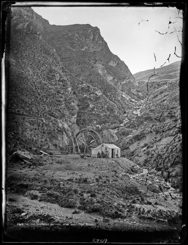
The Maryboro Battery near Macetown, 1876-1880, Te Papa
By the 1880s, the gold had dried up, but 200 quartz miners lived in the town beside the Arrow River.
Peter Petchey, writing for DOC, notes: “… from the earliest days it was recognised that the lack of access to the area was a serious hindrance to mining, as there was no road up the Arrow Gorge from the outside world. All supplies had to be packed in, for £5 per ton, or £10 per ton for heavy timber delivered to the mines.”
In 1881, the government agreed to help locals fund the road “pound for pound” (the accounts show a subsidy of 136 pounds, 9 shillings, and 5 pence to survey the road).
In 1883, Oliver Wakefield, the government’s Under Secretary to the Mines Department, called for tenders to build the Arrowtown to Macetown road.
The road from Arrowtown to Macetown was completed in 1884 for £9,570. The cost of supplies along the route, particularly the timber essential for shoring up mine tunnels, immediately dropped.
In 1885, the Lake County Council debated at length over whether it or the government should control the road, which at the time was in good condition. The government had told the county if it refused to take over Macetown road, it could expect no further grants in aid of the roads and tracks. The council resolved:
“That the Macetown road be taken over at once, and the Government be informed by telegraph of the decision of the Council. The Clerk was instructed to at once wire the motion to the Government and also to urge that tenders be called for the construction of works.”
In 1892, the council stopped maintaining the road because it was concerned that the mining company, Arrow Falls, would jeopardise the road’s safety by sluicing away its claim. Several years later, the council would need to deviate from the road to enable Arrow Falls to work the ground about the old road in its search for gold.
However, despite all this investment and involvement from the council, the road never became a legal road.
By 1921, only one resident remained at Macetown: William Jenkins. Once alone, he promptly declared himself the mayor. But even without a population, people still wanted access along the river to visit Macetown.
During the 1930s Depression, some people moved back, mining on government subsidies, records Peter Petchey.
“There were still a number of habitable buildings standing, together with plenty of firewood from the trees that had grown up in the area, and the road was again being maintained by the Lake County Council. As the Depression eased, miners and their families left, and the last resident was again William Jenkins.”
The road was a dangerous journey, though. In 1899, one of many accidents along the road ended in tragedy. The Evening Star reports:
“Mrs Hood, an old Macetown resident, with the infant son of Mr Harry Birley, was going to Macetown in a single-horse buggy driven by Fred Brown. When near Bracken Gully the horse shied at a live sheep tied up on the roadside, causing the buggy to capsize on a precipice 500 ft above the river. Mrs Hood, the infant, and horse were instantaneously killed, Fred Brown escaping with a few bruises.”
Throughout its history, regular slips have made the road unreliable and hard to maintain.
In 1932 the Wakatipu Mail reported that a big slip came down on the Macetown road at “Britannia Hill”.
“The slip occurred at a high gravelly face, which appeared very solid and had shown no signs of moving since the road was formed close on fifty years ago. Hundreds of tons of earth came down, and the road is at present blocked for wheel traffic. Mr Powell, County inspector, has a gang of men on clearing the road.”
In 1937, Bob Semple, Minister of Public Works, visited Arrowtown and promised an engineering survey of the Arrowtown end of the road. This suggests that a part of the road, at least, would be legalised. Unfortunately, the Undersecretary for the Public Works Department wrote to inform locals several months later of the outcome from the survey:
“As a result of the information thus obtained, the Hon. Minister regrets that the position is so difficult financially that he will be unable to give favourable consideration to any question of construction work.”
During the 1940s, the road was closed for several years for vehicle use, and floods regularly prevented other access.
In 1962, the Press marvelled that someone had managed to drive a car along the rough track to Macetown. If there had been any locals, “they would have had difficulty believing their eyes”. In 1967 the Press looked more kindly on the road, noting that its continued existence testified to the skill of those who built it.
Tourism operators, including horse tours and Mr Grant’s transport tractor, were beginning to use the road for tourism and recreation.
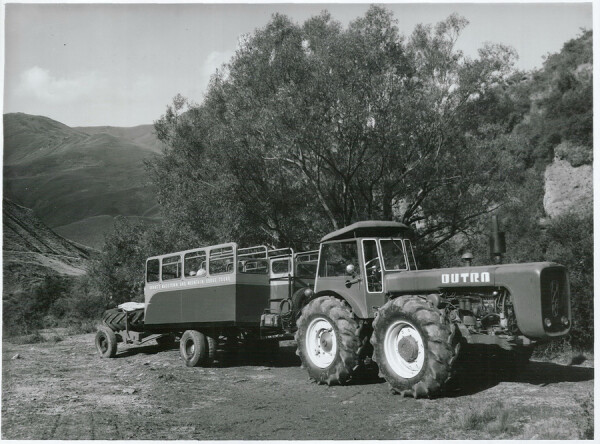
1969, Mr Keith Grant’s transport tractor train, which operated from Arrowtown to Macetown, Archives NZ
Increasing interest in the road over recent decades from 4WDers, mountain bikers, walkers and other recreationists means the Queenstown Lakes District Council needed to take an interest in the state of the unofficial road that it was not legally responsible for. The council has provided some maintenance over the road, including repairing slips and closing the road when it is unsafe. The council’s maintenance is modest, and the track is at risk of becoming unusable, unsafe, or unstable — especially for inexperienced 4WDers.
Because the land is private, access is a privilege granted by the landholders. One of those landholders, Soho Property Ltd , allows access along the road but says the land is extremely fragile, and any damage from misuse takes years to recover.
Macetown Road is well suited to supporting recreational activities like walking, trail running and cycling. Preserving access along the road and ensuring a quality experience that does not harm the environment or endanger recreationists will require a robust management plan and control of vehicle movements. Establishing clear legal access along the road will make it easier for the council and others to put in place a plan to protect the land for future generations.
Topo Map Gallery
See how cartographers have recorded Macetown road over the decades
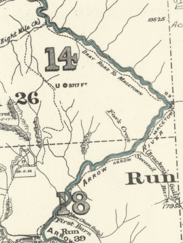
1929
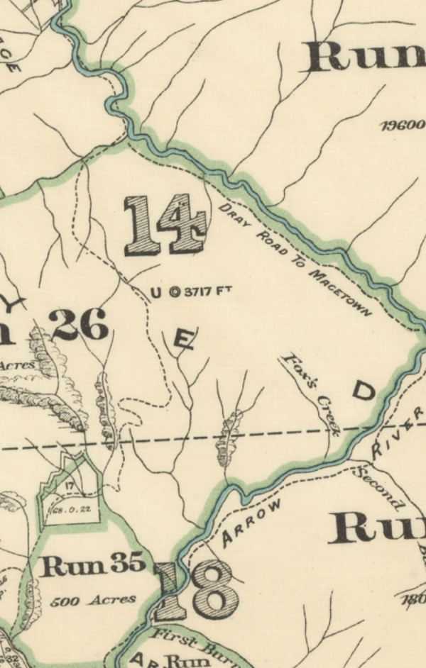
In 1929, the road appeared on the topo map as Dray Road to Macetown.
1939
In 1939, the road was called 'Dray Road to Macetown' and 'Arrow Macetown Rd' on the topo map.
1979
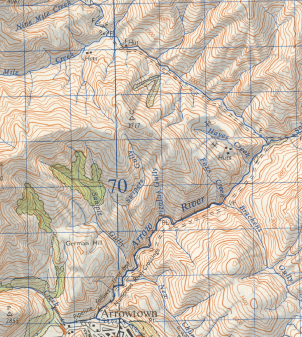
By 1979, the map no longer mentions a road name, just that there are numerous river crossings at the start by Arrowtown.
2009
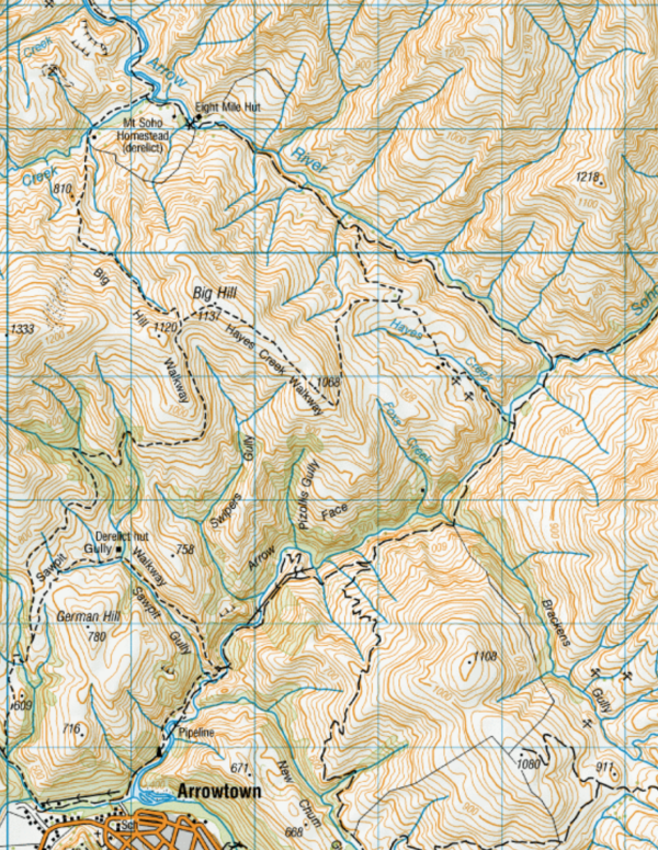
By 2009, there was no road labelling at all. Nothing on the map distinguished it from any other farm track.
2019
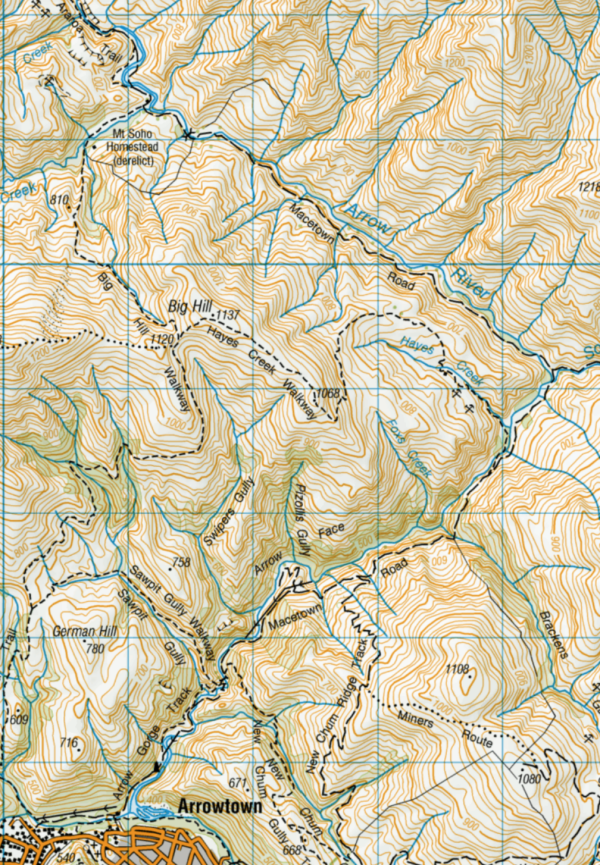
The latest Topo map (after 2019) is the first to label it all as Macetown Road.