ANZAC Day
Take a walk down memory lane back to WWII. ANZAC Day is a chance to commemorate our soldiers in Gallipoli and reflect on our history. We’ve collated just a few of the WWII must-do views from Plan My Walk for your weekend hīkoi.
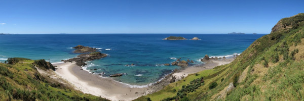
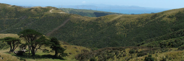
Te Whara Track, Northland
Trace the footsteps of Northland’s Māori ancestors on the original Te Whara Track. This 7.5km track is at least 700 years old. The track is challenging, but the stunning 360-degree views make this one of DOC’s best day hikes. Take in the magnificent coastal panorama at the Bream Head summit, towards Ocean Beach end and not far from the ruins of a WWII radar station. Enjoy spectacular views of Cape Brett (Motukokako) in the north to Cape Rodney (Tawharanui) in the south, as well as the Poor Knights islands Tawhiti Rahi and Aorangi, Taranga and Marotere Islands in the Hen and Chickens Islands group, with Te Hauturu-o-Toi/Little Barrier and Great Barrier/Aotea Island in the far east.
Ensure you’re wearing laced footwear and be careful, as some rocky outcrops have steep drop-offs. The view is well worth the climb.
Maungauika, Auckland
Maungauika/North Head Historic Walk is one of the fourteen Tūpuna Maunga (ancestral mountains) in Tāmaki Makaurau. A series of loop tracks lead to tunnels, guns, searchlights and defences that our soldiers placed on the headland to protect Auckland from feared Russian invasions.
The Coastal Loop, Summit Loop or Tunnels Loop are 2.5km one way. Dogs are welcome on a leash and the walk is wheelchair/pram friendly.
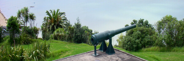
Photo credit: Russell James Smith at Flickr
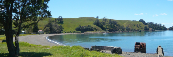
Motutapu Wetland Walk, Auckland
The Motutapu Wetland Track is hidden away on Motutapu Island, just next to Rangitoto Island. The 5.4km track (one way) crosses farmland to Billy Goat Point, which provides a great outlook to the north. You can find WWII telegraph and observation post sites. Take a short detour to discover gun emplacements.
Access to this walk is via ferry, kayak, or charter boat. Remember to bring a water bottle. No dogs are permitted.
Wrights Hill, Wellington
Walk through regenerating native bush and see if you can spot any rare birds on the Wrights Hill Lookout Loop, a 2.4km loop nestled in the Wellington region. Wrights Hill hosts a WWII military fortress where you can enjoy the same sweeping views of the harbour our defence force would have had all those years ago.
There are two loop walks to choose from, the Lookout walk or a shorter Salvation Bush Walk. Dog, bike and wheelchair/pram access is available.

Kilmister Loop, Wellington
The 10.3km Kilmister Loop track has panoramic views of Kelson and Lower Hutt Valley, and then follows the stream up to Belmont Road. On the way back to Hill Road, be sure to keep a lookout for WWII munitions and magazines. Make sure to wear good footwear (lace-up shoes or hiking boots) as you’ll need to cross several streams.
The Kilmister Loop is in the Wellington region and is also mountain bike friendly.
Mt Pleasant Track, Canterbury
Mt Pleasant Track gradually climbs through a rolling tussock landscape to a gravel road. The road takes you to the radio masts at the top of Mt Pleasant. The nearby trig offers 360-degree views oover the city and plains. From there you can follow the track through more tussock to the Mt Pleasant gun emplacements. For a longer journey walkers can contune along the Crater Rim Walkway to the Bridle Path.
Dogs allowed on leash.
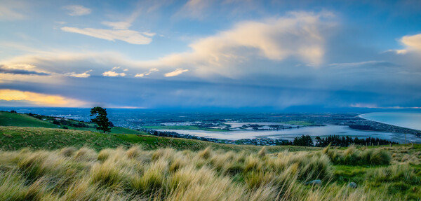
Photo credit: jamesnimmo at Flickr
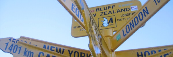
Topuni Track, Bluff
Topuni Track visits an historic WWII gun emplacement then climb steeply through regnerating forest and coastal scrub lands to the summit of Bluff Hill.
Dogs allowed on leash.