Users
Cycling
Cycling in this part of New Zealand is doing relatively well, aided significantly by the funding associated with the NZ Cycleways project. Alps2Ocean cycleway runs through the Mackenzie and Waitaki districts and appeals to both domestic and international tourists, as well as linking a number of the small communities to each other and to the lakes and conservation lands that are within the two districts. A number of locals spoke of a desire to create a network of walking and cycling tracks with Alps2Ocean as a central spine. These new tracks would link together at various points, and would be a resource for locals’ day trips as well as providing alternate options for visitors doing the full Alps2Ocean route.
In Queenstown, the Queenstown Trails Trust is an integral part of walking and cycling planning in and around the area. With 120km of trail already built, the Trust is playing a key role in providing recreation opportunities for locals and tourists, and also has a vision to connect Queenstown with satellite communities throughout the basin such as Arrowtown and Arthurs Point. The Trust is now starting to work more closely with the local mountain bike club on areas of shared interest.
On the other side of the Crown Range, the Upper Clutha Tracks Trust is working hard to build new walking and cycling opportunities in its part of the Queenstown Lakes District. The Trust is also working to link Wanaka with Cromwell, and from there to the rest of Central Otago.
The strength of cycleway development in recent years has been matched with a corresponding increase in use – by locals, and by domestic and international tourists. Challenges in the coming years include looking at infrastructure on some of the longer trails such as toilets and shelters/ picnic areas, and ensuring that the large number of cycleways are adequately linked into each other and to the main centres, to better allow for cycle-touring and long-distance rides.
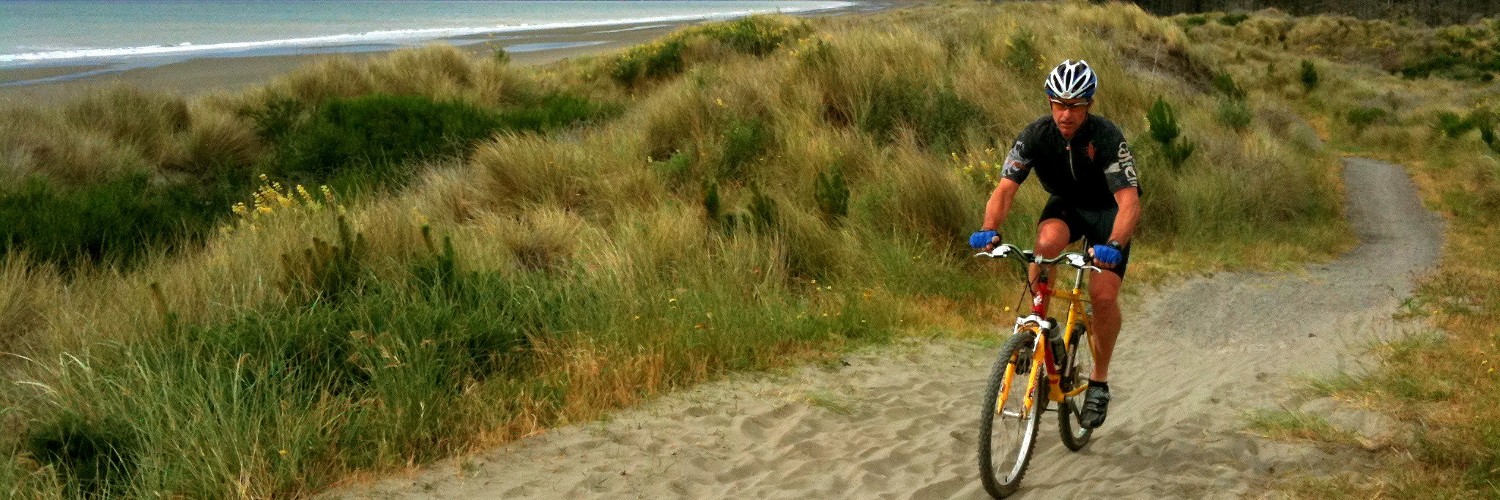
Mountain biking
The mountain biking community is largely self-organised and very motivated. Each of the major parts of the region has their own mountain bike club, and each made serious claims as to why their area offers the best mountain biking experience in New Zealand.
The Clubs are often responsible for building and maintaining their own tracks, often on land (particularly plantation forestry) owned by their local council, and sometimes on Department of Conservation land. Some of the tracks they build are open for walking as well, although they are built for mountain bikers to have priority, and there can be the occasional clash between the two user groups.
As well as the downhill tracks, mountain bikers want to develop single and multi-day cross-country routes, which are more difficult to find. While some longer trails have recently opened up in the northern South Island (the Heaphy Track, Old Ghost Rd), there are currently limited opportunities in the southern central South Island.
Some mountain biking clubs have negotiated with landholders for access to private or crown pastoral lease land, and this generally has worked well, though mountain bikers noted that it was getting harder to negotiate new access, particularly where land ownership had changed (resulting in a loss of relationships) or where farm type had changed to more intensive use such as dairying.
Challenges in the near future for mountain bikers include maintaining relationships with the Department of Conservation and local councils to ensure they can take up any new opportunities, and continuing to find funding to supplement volunteer labour for construction and maintenance. Mountain bikers can find it hard to get funding from councils, who are more likely to fund walking and cycling projects, and work will need to be done to address this. This work can build on what has already been done, such as the Queenstown Mountain Bike Club’s report on economic benefits for the region from mountain bike tourism.
Lastly, a perception exists amongst a number of landholders and other outdoor users of behaviour problems amongst mountain bikers. This perception will need to be countered, and where behavioural issues exist, they will need to be dealt with, in order for mountain biking to continue to thrive.
Day walking
The growth in cycle trails also provides an opportunity for day walkers, as these are generally multi-use trails and can enable shorter walking experiences. However, day walking is a much more casual hobby and therefore there are a lack of advocates for what day walkers need in planning discussions.
Outside of the main centres, day walkers are generally using infrastructure which has been in place for decades. Thanks partly to social media, some tracks are becoming crowded, such as Mt John near Tekapo and Roys Peak near Wanaka.
Additionally, landholders have closed off access to some tracks that cross private land due to issues caused by numbers and/or behaviour, such as the Mount Alfred Track.
The creation of new tracks for day-walking will likely be on private land, or on access created through the Overseas Investment Act or Tenure Review processes. For the former, it will require considerable volunteer effort backed by the Walking Access Commission, while the latter will require a focus on enabling track creation by a range of Government agencies including Land Information New Zealand, the Department of Conservation and the Walking Access Commission.
Day walking is perhaps the most accessible way to get into New Zealand’s outdoors, and as such, is perhaps the most susceptible to tourism pressures. While domestic and international tourist day walkers bring significant money into an area, they don’t have the same direct spend on equipment and experiences that many other modes of accessing the outdoors do, and therefore it can be hard to get the focus required on their needs when planning for new public access.
Tramping
Traditionally, trampers have been well-served by the region’s significant amount of conservation land with many trails and huts to be found within.
One issue is the availability and maintenance of huts, with the Department of Conservation no longer maintaining many – though they have provided funding to the Outdoor Recreation Consortium which now maintains a number of huts. Some huts have been closed however, and, particularly in peak season, space can be hard to find in some areas.
Te Araroa runs the length of the island north-south, and provides a spine for other trails to branch from. The existence of Te Araroa has meant that numbers have significantly increased in areas that were previously only infrequently visited, meaning that huts built for smaller numbers of guests are no longer fit for purpose.
Another issue is the displacement of people. As popular areas are becoming more and more busy, people are moving to less popular and more remote areas seeking more rewarding outdoor experiences. This forces people who want an even quieter experience to push further afield, visiting areas that previously might have only been used by those wanting solitary experiences.
These people are then forced to go even further into the backcountry, and so on. This displacement runs through 3 or 4 tiers, and means that some of our pristine wilderness areas are seeing increased numbers (even off a very small base) that they simply aren’t used to coping with.
Horse riding
Nearly every person we asked the question “Are there any specific types of outdoor access you think are most poorly served in this area?” gave the same answer: horse riding.
Horse riders have probably been the group most negatively impacted by the growth in cycleways due to the perception that bikes and hooves don’t mix. Because of this, most of the new cycleways constructed have been built to a standard that means horse-riding cannot occur on them, and this includes some areas where horses have been ridden for some time.
To make matters worse, horse riders have some of the same issues that mountain bikers have with the changing nature of farming — increased intensification and changes in ownership — meaning that long term access on handshake agreements is increasingly being denied.
The horse riders are starting to organise themselves into groups, like cyclists and mountain bikers have, to try to address these issues collectively and this is a positive step that may help with the creation of new bridle paths and ensuring that horse riders needs are thought of in central and local government planning processes.
Hunting
For hunters, the major issue is getting access to conservation land that involves crossing private land. The traditional methods of phoning the farmer and asking for permission are proving trickier as ownership changes and relationships are lost, and farmers are (understandably) cautious about allowing people onto their land with firearms.
The Walking Access Mapping System has been useful for hunters, however, to identify where legal public access already exists to enable them to reach their destination.
For duck hunters, one unexpected problem has been the rise of freedom camping. More people are staying alongside waterways for more of the year than previously, and this has resulted in traditional hunting areas being lost due to the risk to human life if people were to hunt in them.
The Tenure Review and Overseas Investment Act processes are seen as having a key role to create new access for hunters to cross farms and reach hunting blocks. Hunters told us that results from these processes have thus far fallen short of expectations (as they have for trampers, walkers and cyclists for the most part).
Landholders spoke to us of often finding hunters on their property without permission, and the fear it put into them that if they confronted them, something bad might happen. Relationships between local hunting groups (NZ Deerstalkers Association, NZ Fish and Game) and landholders will need to be improved in order to change things.
Additionally, the creation of formalised access can assist significantly. Some landholders we spoke to had formalised public access on their property not necessarily because they wanted to as a matter of principle, but because it made their lives easier – instead of having to answer phone calls or knocks on the door, they had clearly marked and well known public access with conditions, and it meant they didn’t have to worry about it any longer.
Fishing
Like hunting, anglers typically want access across private land to reach rivers, which often have marginal strips or esplanade reserves running alongside them. It is this (often quite small) piece of access across private land to a public access area that can prove trickiest.
Fish and Game NZ have a number of fishing spots that are well signposted on the ground, and available online, for people to use. However, experienced anglers are often interested in finding their own quiet spots, away from other people, and many use the Walking Access Mapping System to do so.
The Overseas Investment Act and Tenure Review processes are also vital for angler access to and along waterways, and there has been some, albeit relatively limited, success in this.
Anglers are well-organised to advocate for themselves, though relationships with landholders can be tense at times. Some landholders spoke to us about banning Fish and Game license holders from crossing their property due to what they perceive as negative stereotyping of farmers from the organisation. If this continues and grows, it could result in significant loss of fishing spots across the region.