Access along rivers, lakes and the coast
Many of our country’s water margins and riverbeds are open to public access. Learn about waterway access types, including erosion’s impact and the truth about the Queen’s Chain.
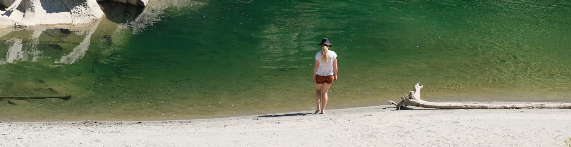
Access to waterways for recreation, health, transport, sustenance and wellbeing is an important cultural right and expectation for many New Zealanders. Ngā ara o ngā wai — waterways as pathways — integrate with land-based paths and are essential for tangata whenua. These were often the primary routes for our ancestors to connect to each other.
Our maps
Explore our maps to find public access areas beside water. The types you might see include:
- legal road – often unformed legal road
- marginal strip
- esplanade reserve
- esplanade strip.
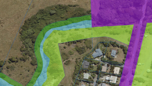
A marginal strip (dark green) runs along the north side of this river section. An esplanade reserve (turquoise) runs along the south side. Both areas connect with legal road (purple) to the east. Open in map
You can also find angling spots:
Open the map and turn on the 'Hunting and fishing' layer (provided by Fish and Game New Zealand) then see what happens when you click an angling icon.
The Queen’s Chain
The Queen’s Chain is more aspirational concept than fact. It’s commonly pictured as a one-chain (20m) wide strip of public land along all water margins. In reality, waterside public access is plentiful, but not complete.
Learn about the evolution of laws for marginal strips
Improving access to water
We work with others to improve public access to water. Here’s one example:
7 km of new fishing access at Rangitata: Our advice to the Overseas Investment Office regarding an overseas investment consent helped to secure a 7km esplanade strip along the true left of Rangitata River and two connecting access strips totalling about 800m in length.
Learn more about making trails if you’d like to get involved with access development.
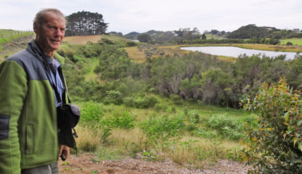
Assisting walkway development at Lake Gem in the Far North as part of an Overseas Investment Office consent
Protecting access from erosion
What happens when a track collapses into a river or is submerged by rising sea levels? Many access types are lost through erosion, though they may expand through accretion.
The following access types move with water boundaries to ensure public access endures into the future. That’s why we advocate for their use over others where appropriate.
- Marginal strips established on or after 10 April 1990
- Esplanade strips
If the river has eroded through a road parcel, that parcel will continue to be road and retain legal road rights. If the river has eroded through other types of fixed river margins, the land parcel then becomes part of the riverbed.
Coastal access
There are many coastal trails around New Zealand, but it’s not possible to walk around the entire coastline on public land. Some coastal land is private, and some is too sheer or otherwise impractical to access.
Below the high tide mark, the coastline is generally open to public access, with some exceptions.
Our maps include public access areas that border the coast, but they do not show low-tide access. Contact the local or regional council to check low-tide access permissions for a specific area.
Learn about public access on the marine and coastal area (the foreshore and seabed)
Riverbed access
A publicly accessible riverbed allows us to enjoy a cooling paddle after a picnic, and it can be invaluable when we need a route around inaccessible land.
Here’s how to determine riverbed access.
Does the river adjoin public land?
Open our map and zoom in on your area of interest. If the water adjoins legal road, esplanade reserve, reserve land or DOC public conservation land, you can most likely access the riverbed from that land at least up to the river’s midpoint.
Is the river navigable?
You can usually enter the larger rivers in New Zealand legally. A river is navigable if it can be travelled by boat, barge, punt or raft. Riverbeds of navigable rivers usually remain vested in the Crown. There are a few exceptions to this though, such as Te Awa Tupua (Whanganui River), which owns itself. Generally, access to navigable rivers will only be opposed if there’s a conflicting use, such as hydroelectric damming or a grazing lease. These exceptions are not shown on our maps.
Does the river adjoin private land?
Where an unnavigable river adjoins private land, there’s unlikely to be public access to that half of the riverbed. This is due to the common-law right usque ad medium filum aquae (AMF), meaning ‘to the centre line of the river’. It applies where the private land boundary is the unnavigable river, rather than a pegged survey line.
Not sure?
If you’re having trouble determining public access, you can ask one of our regional field advisors for help.
Disagreements
Legal water boundaries are defined according to each land parcel’s survey plans. The mix of property rights is complex, so expert advice is required when there are disagreements.
We may be able to help, but complicated cases are likely to require a survey, and may require court resolution.
Publications
Read more about the legal background and detail regarding access to rivers, lakes and the coast.
Roads, water margins and riverbeds: The law on public access, Hayes 2008