Filter by Date:
Regional field advisors
Contact an advisor to investigate or negotiate public outdoor access.
Pocket Maps
Get the app to take our maps with you just about anywhere.
Refreshed access maps help landholders know their land
Posted under: Maps
Published 5 April 2024
By Inger Perkins. Republished with permission from West Coast Grassroots
Herenga ā Nuku has recently refreshed all our outdoor access maps to make it easier to read, annotate and share them. Farmers, foresters, and other landholders will find this particularly useful.
As a farmer, forester, or landholder, it can be intimidating to navigate outdoor access requirements. Most landholders want to share and showcase their land with local visitors. But they also want to protect their land, animals and plants. That’s why Herenga ā Nuku has a comprehensive suite of digital maps showing outdoor access in New Zealand.
One challenge facing landholders and farmers is ensuring that they comply with public access requirements. Herenga ā Nuku’s maps mean you can see which areas of your land are covered by which regulations, and what public access already exists. This means less time poring over complex legal documents or trying to decipher confusing maps - we have done the hard work for you.
Another factor to consider when it comes to outdoor access is the safety and security of your land. Herenga ā Nuku’s maps allow you to see exactly where there is access adjacent to or across your land. This means you can more easily monitor who is coming and going, give health and safety advice to visitors and act if you notice any suspicious activity. You can use the maps to identify areas of your land that may be popular with recreationists and take steps to develop a good relationship with them that helps protect the land and your operation.
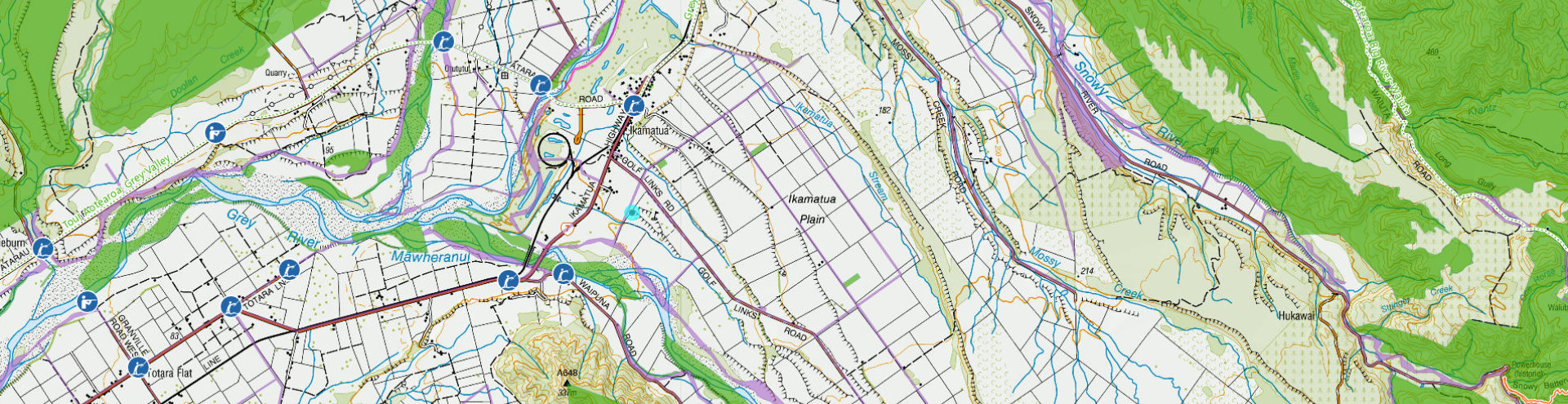
Sample map in Ikamatua area with Topo 50 basemap, property boundaries, legal road parcels - formed and unformed, public conservation areas, tracks and trails, angler and hunting access points and public access easements.
By making it easier for people to understand where they can and can't access your land, you can avoid misunderstandings and conflicts. This can be a great way to build goodwill in your community and promote your business.
Herenga ā Nuku has recently improved its maps by adding new features. An important new addition is Google logins – this will let you log into the map system using your Google identity so you can save your work (drawings, labels, zoom location and so on), share it with your friends and family and come back to it at a future time.
We have also made changes to our information pop-ups — we simplified the language and information on all the map pop-ups, making it easier for first-time visitors to know what they are looking at. The different categories of public access – easements, marginal strips, legal roads and so on — all link through to plain language descriptions that explain people’s rights on that land.
We have improved the way we show boundaries, hunting and fishing areas, and a variety of other symbols to make it easier to know what you are looking at. And then we have calibrated all our maps, ensuring a consistent look and feel.
And, after a lot of requests, we have made the popular and detailed Topo 50 map the default basemap for all our maps.
We hope you enjoy using the maps - We always welcome queries, comments and suggestions for improvements.
Inger Perkins is the West Coast Regional Field Advisor for Herenga ā Nuku Aotearoa, the Outdoor Access Commission.
Page last updated: 8 April 2024