Improved maps bring Kopurererua Stream into view
Herenga ā Nuku is adding 20-50 esplanade strips to its maps every month as it improves the quality of data it provides to outdoor recreationists.
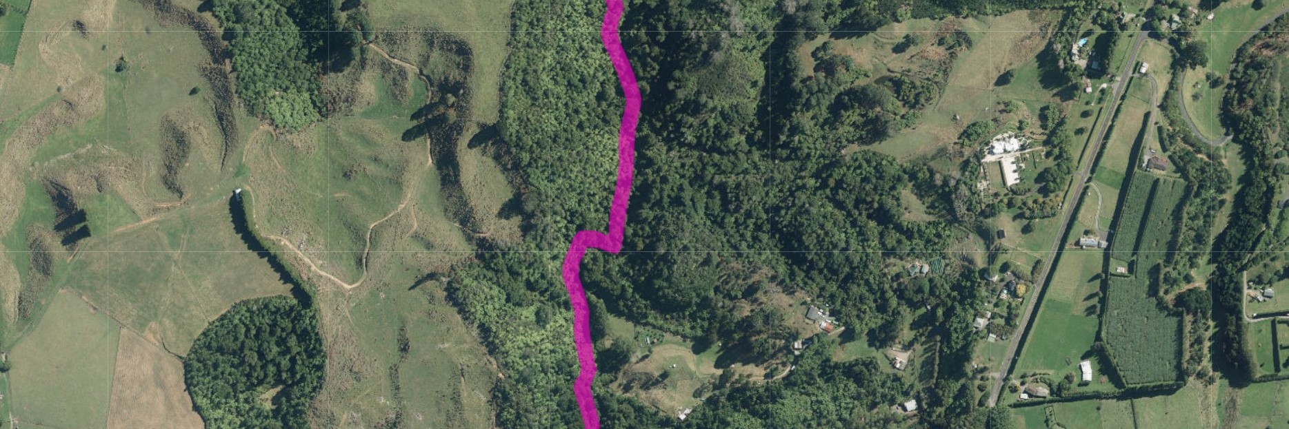
One example of these newly visible esplanade strips is in the Bay of Plenty, where map viewers can now see a previously hidden strip of public access along the Kopurererua Stream near Pyes Pa. The stream flows from deep inland at the Mamuku Plateau to the Tauranga Harbour. The newly visible esplanade strip is about 700m long and links two large sections of public access that had appeared unconnected — an esplanade reserve coming off Taumata Road and a Te Papa Conservation Area near Omanawa.
Esplanade strips are a form of easement that sit on land beside a river or lake and are usually 20 metres wide. They provide people with public access beside or along a watercourse
“When people have good map information that allows them to explore the outdoors and swim, fish or walk beside rivers or streams, that’s good for all of us,” says Herenga ā Nuku chief executive Ric Cullinane.
“Walking beside Kopurererua Stream, or sitting on its banks, is free. And it is good for our mental and physical well-being. It connects us to te taiao and it brings us together as a community.”
Cullinane says the data improvement plan will continue to make access to more rivers, lakes and forests visible to people who want to enjoy the outdoors.
“Our goal is to have maps that show all public access in New Zealand on our maps, says Cullinane. “We know we have a way to go, but we are making big improvements, which means people can rely more on the data we give them.”
Herenga ā Nuku maps are the most comprehensive and accurate data set of public access areas in New Zealand. But they are not a complete set. in 2018 Herenga ā Nuku commissioned a report which identified in the public access data it is able to display on its maps. This includes longstanding public access that had not been digitised at the time and other information that was not part of the cadastre. This year the operations team and the GIS team at Herenga ā Nuku are working together to fill in as many gaps in that data as possible.
Examples of other newly visible esplanade strips include access to the stream behind St Patrick’s College Silverstream, to Tukituki River near Havelock North, and to Kaihihi Stream connecting to Ōkato Coast.
As well as esplanade strips, the team is also adding walkways, public rights of way and access strips. They also have a long-term project to back-capture old Public Access Easements that still need to be digitised.
Eagle-eyed users of the maps will see all these newly visible public access areas appearing on the maps over the coming months.
Open the map showing all layers