Get outdoors on World Car-Free Day
Trails connect us to the land and to each other, but what transports us to these trails is all too often a car. So, in celebration of World Car-Free Day (22 September 2022), we asked some of our regional field advisors to share their favourite local walking and cycling trails – but only those that can be reached without a car.
Northland | Te Hiku-o-te-Ika
Regional field advisor: John Gardiner (Vacancy)
Climb Mount Parihaka
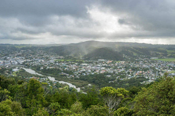
The view from Mount Parihaka summit. Photo itravelNZ (CC BY 2.0)
Get there car-free: Either walk the Hātea River walkway from Victoria Bridge, or take the #3a Kamo bus (Mon-Sat) to Deveron St and walk to the Mair Park entrance
John says:
"Mount Parihaka was once the site of the largest pā in New Zealand. The well-formed track steadily climbs through beautiful mature podocarp forest to a stunning lookout.
It provides a great workout. Allow 1.5 hrs for the round trip."
CityLink timetables – These buses are free on World Car-Free Day
Auckland
Tāmaki Makaurau
Regional field advisor: Dot Dalziell
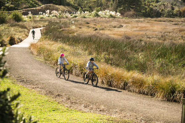
Wander Puhinui Stream Forest Trail, Totora Park
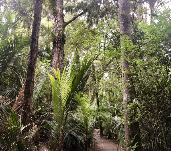
Puhinui Stream Forest Trail. Photo: Megan Hannett via Wild Things
Get there car-free: Catch the #366 bus from Manukau to the Botanic Gardens (get off at Stop 6740 or stay on longer to reach the southern entrances)
Dot says:
"The Puhinui Stream Forest Trail is a loop through time. Wending among Gondwana sculptures and ancient plants in the Botanic Gardens, the trail leads on through forest shade into Totara Park, crossing the Puhinui Stream several times and returning via Scouts Field (a youth camp in the 1960s).
You're walking in the footsteps of the ancestors, and if—like me—you're curious about history, or online games (eg, Pokemon), check out Ara Journeys' downloadable avatar, Manu, which relates mana whenua stories of the area in a game called Puhinui Stream Challenge.
The trail takes you to picnic spots, swimming pools, playgrounds and good coffee at the Botanic Gardens' café."
Puhinui Stream Forest Trail brochure
Waikato and Taupō
Regional field advisor: Felicity Brough
Meander along Te Awa River Ride
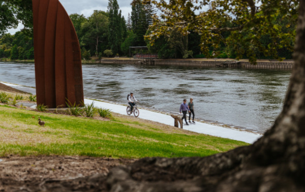
Waikato River and Joe Citizen's sculpture Tōia Mai. Photo: Brian Perry Charitable Trust
Get there car-free: Set off from anywhere on the open sections, or ride the #21 bus one way between Hamilton and Ngāruawāhia
Felicity says:
"I like the section of Te Awa River Ride that runs from Hamilton Gardens to Ngāruawāhia. It runs through the city, so you can walk to it from the centre of town – Shanks' pony is the best option to get there.
You can walk or cycle it, observing the Waikato river as you go. The paved surface is great. It's really opened up views of the river, which previously you couldn’t see. You can do as much or little of it as you like."
Ngāruawāhia to Hamilton - Te Awa (The River)
Hauraki, Thames Coromandel and Bay of Plenty
Hauraki, Te Tara-o-te-Ika-a-Māui me Te Moana-a-Toitehuatahi
Regional field advisor: Lauren Schick
Explore the Ōmokoroa Cycle Trail
Ōmokoroa to Tauranga Cycleway. Photo: Western Bay of Plenty District Council
Get there car-free: Take the #81 bus from Tauranga to Ōmokoroa (weekdays only)
Lauren says:
"You can catch the bus out to Ōmokoroa from Tauranga on a weekday and then do the really cool cycle/walk back into Tauranga town along the coast. It's fun for all ages, with beautiful scenery as it passes through coastal wetlands, an old Pa site, parkland and beaches
I’ve only biked it; it might be a long walk – it’s a 19km trail! You could walk for a bit, then turn around and take the bus back again."
Bay Bus timetables – These buses are free on World Car-Free Day
Wellington and Wairarapa
Te Whanganui-a-Tara me Wairarapa
Regional field advisor: David Barnes
Traverse the Puke Ariki trail, Belmont Regional Park
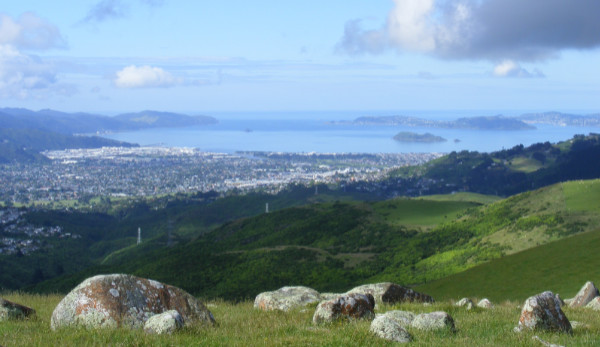
Wellington Harbour/Te Whanganui a Tara from Puke Ariki. Photo: David Barnes
Get there car-free: Take the Hutt Valley Line train from Wellington (get off at Petone Station to head north, or Manor Park Station to head south)
David says:
"If you’re keen on 7–8 hours of walking and comfortable with navigating, the Puke Ariki trail offers great views. You’ll walk the length of Lower Hutt’s western hills – right behind my house!”
Note: Parts of this track are currently closed for lambing.
Puke Ariki/Haywards Korokoro Traverse
Queenstown Lakes and Southland
Tāhuna me Te Taurapa o Te Waka
Regional field advisor: Vacancy
Swoon at the scenery on the Sawpit Gully loop
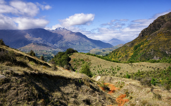
Sawpit Gully Walkway. Photo Curtis Simmons (CC BY-NC 2.0)
Get there car-free: Take the #2 bus from Queenstown to Arrowtown (get off at Ramshaw Lane)
Ange, our previous field advisor for the region, says:
"Although this is only a 1.5–2 hr loop on Arrowtown’s back doorstep, it’s a grunty walk—more akin to a backcountry route—with a roughly formed trail through destocked healing land.
Head towards the Historic Arrowtown Chinese Settlement. Behind the toilets you'll see a small footbridge and a dirt track. Go left here and follow Bush Creek until you cross another bridge and reach a track junction. Head up the steep narrow track through regenerating natives and remaining wilding pines until you hit Eichardts Flat, the highest point on the walk (about 45 mins).
Stop and take in the breathtaking scenery – great views of the Wakatipu basin including views of the Remarkables and down over Millbrook. Brow Peak and German Hill loom up on either side.
Follow the narrow, and at times rocky, Sawpit Gully Walkway downhill until you hit the Arrow Gorge Track. Turn right to follow the Arrow River back to Arrowtown.
Before you catch the bus back home, refresh yourself in one of Arrowtown's many fantastic cafés and bars."
Mahu Whenua Arrowtown trails map
Orbus timetables – These buses are free on World Car-Free Day
When there's no access
Obviously, the above shows just a few examples from around the country. Hopefully you have access to some local trails where you are, whether by car, public transport or on foot.
If you're not sure whether an area is publicly accessible, check our maps. And if you'd like to talk to someone about a public access opportunity or dispute, you can learn about access to the outdoors and contact your regional field advisor.
Happy World Car-Free Day!