News from the field
The joy of trails - Felicity Brough
My role as a regional field advisor (RFA) is highly varied, but seeing new trails developed is one part that I particularly enjoy. The Coromandel Peninsula is an area with many new and exciting walkways under development, each with its own flavour. Traditionally, a walkway was just that, for pathway for walkers, but now tracks are designed with multiples uses in mind. On one trail, you can ride your bike with your dog in tow on a leash, while other trails provide a more rugged walking experience.
Here are three examples of trails in under development that cater for different types of users:
- a hiking track planned for the Eastern Whitianga Harbour, where trampers will enjoy sea views. The trail will cater for fitter people who are happy to follow a poled route;
- a walk around the Inner Tairua harbour, that connects one part of the town to another alongside a golf course. While this is a more urban setting, it has a beauty and tranquillity of its own, with an easy contour and relaxing views of the sea;
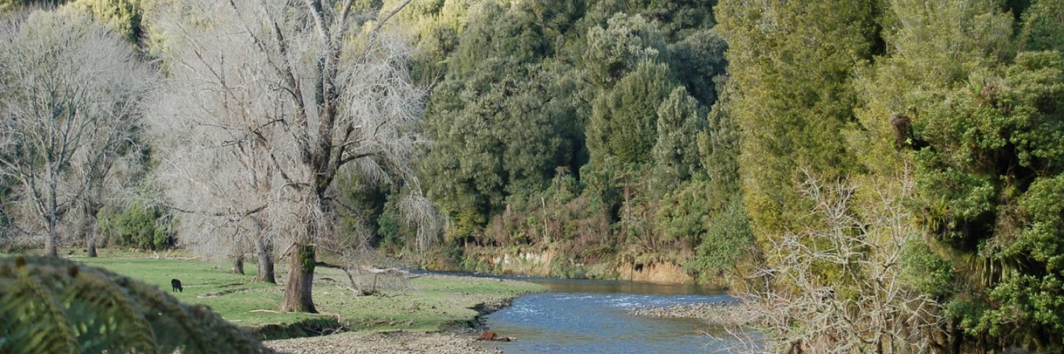
- the Pauanui – Tairua Trail aims to link these two coastal settlements. So far, 4.2 km of track has been constructed from Pauanui along the Tairua River to Duck Creek. An application for resource consent has been submitted for the next 6km, from Duck Creek to Hikuai. The trail provides a scenic and safe route alongside the river, which will largely take users away from a busy road. Plans are being formulated to start up the trail from Tairua.
The commitment and vision of the volunteers who create these trails is impressive and inspiring. They are creating a permanent legacy of public access along or near waterways for all to enjoy.
As an RFA I provide support to these trailblazers, from helping them to understand the land ownership of their proposed route, to creating a strategy that ensures enduring access, looking into surveying requirements, and supporting their liaison with landholders, be they private individuals or public entities.
From the new to the old, I also work clarifying access. One recent example of this has been the process of re-establishing access to the upper Awakino River. Working with the landowners, the Department of Conservation (DOC), Fish & Game and the Waitomo District Council, how the public can access the popular river has been clarified, with new signage erected to explain this. Now, the public can comfortably use the river for fishing, swimming and for connecting to the nearby DOC walk to Leitch’s Clearing.
Ruakokoputuna River Walk – Chris Ward
An overseas buyer recently purchased Ruakokoputuna Forest, next to the Aorangi Forest Park in the Southern Wairarapa. The purchase was subject to the Overseas Investment Act, and as part of this process, creation of a public walking track along the river was made a condition of the purchase.
The Walking Access Commission is working with the IFS Growth, the forest manager, to establish the new track which will run through the forest, up the river, before walking out of the river at a point higher up and completing the round trip on the road. The walk takes about 90 mins and includes some excellent picnic spots. Where there are bluffs or deep pools, the track will pass through the forest.
The walk up the river is delightful, flanked with native forest and some impressive cliffs, and the water quality is good. The river is not known as an important trout fishing river, but Fish and Game advise that spawning does occur.
As soon as forest harvesting is completed, development of the track and installation of signage will begin. Ample parking is also planned for the top and bottom entry points.
A little further up the Ruakokoputuna river is the well-known cavern walk. Access to the cavern is over private land and a commercial operator needs to be contacted regarding entry.
This is another attraction for the area, and the local community is excited about the prospect.