How to find unformed legal roads
Unformed legal roads can be a great recreational asset, providing public access to the outdoors. However, they’re often indistinguishable from private land and aren’t shown on Topo maps. You can find unformed legal roads by using the Public Access Areas layer on our maps and comparing it with formed roads on the NZ Topographic basemap.
Open our Outdoor Access Map and zoom in on the area of interest.
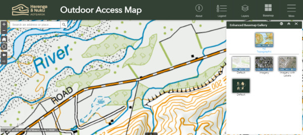
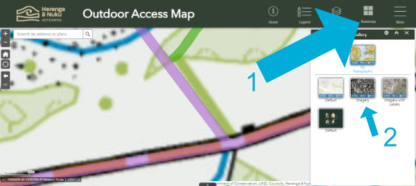
Then change the basemap to NZ Topographic.
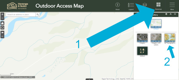
The Basemap icon is a four-square grid (on smaller screens, you'll find it in in the top-right menu)
Next, we'll make sure we can see the layer that shows public access areas.
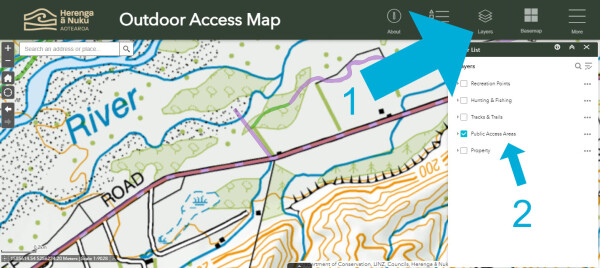
The Layers icon is a stack of three sheets. Make sure only the Public Access Areas layer is turned on
The purple lines indicate legal road parcels. Let's zoom in.
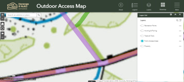
There appears to be a legal road, in purple, that isn't shown on the Topo map underneath
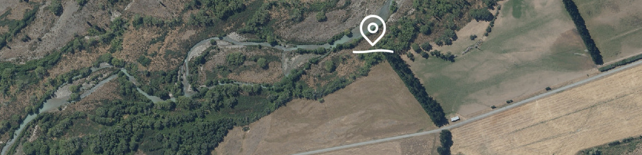
This is an unformed legal road. Let's see how it looks in a recent photograph by switching to the Imagery basemap.
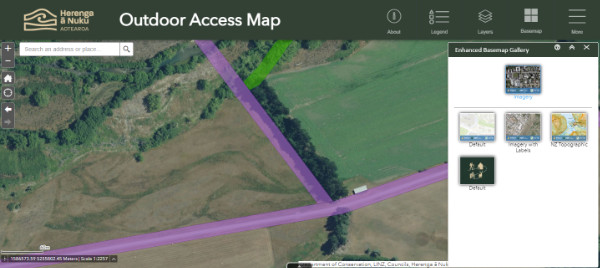
The Imagery basemap shows a photographic view.
By zooming in and switching off the Public Access Areas layer, we can see that the access here may be unmarked.
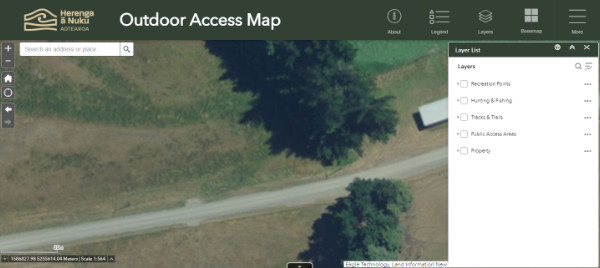
Keep in mind that these photos may not be up to date.
Get the Pocket Maps app to help you locate access boundaries in your current location, even when there's no reception.
You can legally access unformed legal roads just the same as you do other public roads. Avoid confrontations with adjoining landholders. They may not be aware of the public access rights associated with legal roads and may treat you as a trespasser.
Read more about unformed legal roads